Antifílippoi geodata
Antifílippoi (East Macedonia and Thrace) is a populated place; located in Greece in Europe/Athens (GMT+3) time zone. With population of 869 people, there are 1172 cities with bigger population in this country. Compared to other cities in Greece, 90% of cities are located further ↓South; 81.3% of cities are located further ←West and 51.8% of cities have lower elevation than Antifílippoi. Note1
Administrative division(s):
- Level 1: East Macedonia and Thrace
- Level 2: Nomós Kaválas
- Level 3: Dimos Pangaio


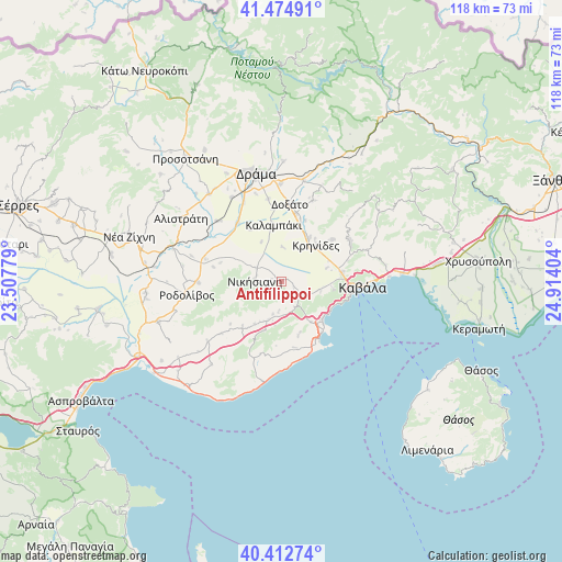
Antifílippoi GPS coordinates[2]
40° 56' 45.456" North, 24° 12' 39.276" East
| Map corner | latitude | longitude |
|---|---|---|
| Upper-left | 41.47491°, | 23.50779° |
| Center: | 40.94596°, | 24.21091° |
| Lower-right: | 40.41274°, | 24.91404° |
| Map W x H: | 118.1×118.1 km | = 73.4×73.4mi |
| max Lat: | 41.72048° ⇑10% North |
| Antifílippoi: | 40.94596° |
| min Lat: | ⇓90% South 34.8346° |
| min Long | Antifílippoi | max Long |
| 19.40494° | 24.21091° | 29.59361° |
| W 81.3%⇐ | ⇒18.7% E |
Elevation
Elevation of Antifílippoi is 88 m = 289 ft, and this is 80.9 m = 265 ft below average elevation for this country.
| Max E: |
1439 m = 4721 ft | 48.2% |
| Avg. | 168.9 m = 554 ft | |
| Antifílippoi | 88 m = 289 ft | |
Min E: |
0 m = 0 ft | 51.8% |
See also: Greece elevation on elevation.city.
Geographical zone
Antifílippoi is located in North temperate zone (between Tropic of Cancer and the Arctic Circle). Distance of this Northern Tropic circle is 1946.8 km =1209.7 mi to South.| Distance of | km | miles | from Antifílippoi |
|---|---|---|---|
| North Pole | 5454.3 | 3389.1 | to North |
| Arctic Circle | 2848.4 | 1769.9 | to North |
| Tropic Cancer | 1946.8 | 1209.7 | to South |
| Equator | 4552.8 | 2829 | to South |


Nearby cities:
15 places around Antifílippoi: (largest is in red/bold)
• Amisianá
10.8 km =6.7 mi,  97°
97°
• Amygdaleónas
12.7 km =7.9 mi,  81°
81°
• Avlí
8.5 km =5.3 mi,  198°
198°
• Eleftheroúpolis
4.9 km =3 mi,  136°
136°
• Eleftherés
11.6 km =7.2 mi,  161°
161°
• Georgianí
5.4 km =3.4 mi,  282°
282°
• Kalampáki
11.8 km =7.3 mi,  348°
348°
• Kokkinóchoma
8.4 km =5.2 mi, 104°
• Krinídes
10.4 km =6.5 mi,  43°
43°
• Lydía
11.1 km =6.9 mi,  32°
32°
• Mousthéni
12.4 km =7.7 mi,  221°
221°
• Nikísiani
5.7 km =3.5 mi,  271°
271°
• Palaiochóri
2.8 km =1.7 mi,  264°
264°
• Palaió Tsiflíki
12.6 km =7.8 mi,  111°
111°
• Panagiá
5.9 km =3.7 mi,  154°
154°
Sources, notices
• [Note1] Compared only with cities in Greece existing in our database
• [Src1] Map data: © OpenStreetMap contributors (CC-BY-SA)
• [Src2] Other city data from geonames.org with taken over terms of usage.
• [Src3] Geographical zone / Annual Mean Temperature by Robert A. Rohde @ Wikipedia
