Karpathos geodata
Karpathos (South Aegean) is a populated place; located in Greece in Europe/Athens (GMT+3) time zone. With population of 2,243 people, there are 456 cities with bigger population in this country. Compared to other cities in Greece, 94.2% of cities are located further ↑North; 99% of cities are located further ←West and 75.5% of cities have higher elevation than Karpathos. Note1


Karpathos GPS coordinates[2]
35° 30' 25.236" North, 27° 12' 47.592" East
| Map corner | latitude | longitude |
|---|---|---|
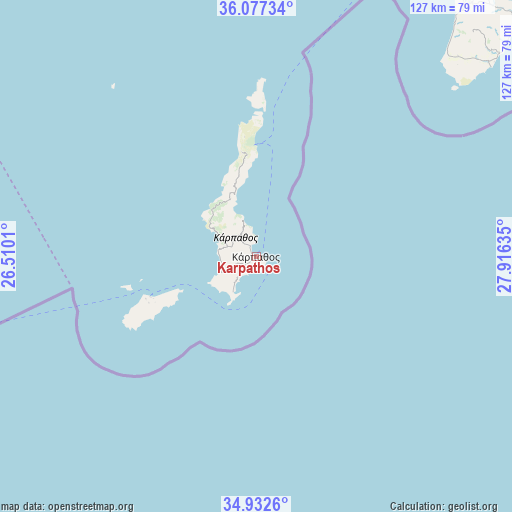
| Upper-left | 36.07734°, | 26.5101° |
| Center: | 35.50701°, | 27.21322° |
| Lower-right: | 34.9326°, | 27.91635° |
| Map W x H: | 127.3×127.3 km | = 79.1×79.1mi |
| max Lat: | 41.72048° ⇑94.2% North |
| Karpathos: | 35.50701° |
| min Lat: | ⇓5.8% South 34.8346° |
| min Long | Karpathos | max Long |
| 19.40494° | 27.21322° | 29.59361° |
| W 99%⇐ | ⇒1% E |
Elevation
Elevation of Karpathos is 23 m = 75 ft, and this is 145.9 m = 479 ft below average elevation for this country.
| Max E: |
1439 m = 4721 ft | 75.5% |
| Avg. | 168.9 m = 554 ft | |
| Karpathos | 23 m = 75 ft | |
Min E: |
0 m = 0 ft | 24.5% |
See also: Greece elevation on elevation.city.
Geographical zone
Karpathos is located in North temperate zone (between Tropic of Cancer and the Arctic Circle). Distance of this Northern Tropic circle is 1342.1 km =833.9 mi to South.| Distance of | km | miles | from Karpathos |
|---|---|---|---|
| North Pole | 6059.1 | 3764.9 | to North |
| Arctic Circle | 3453.2 | 2145.7 | to North |
| Tropic Cancer | 1342.1 | 833.9 | to South |
| Equator | 3948 | 2453.2 | to South |


Nearby cities:
15 places around Karpathos: (largest is in red/bold)
• Afántou
122.3 km =76 mi,  44°
44°
• Análipsi
123.4 km =76.7 mi,  245°
245°
• Apóllona
107.9 km =67 mi, 39°
• Archángelos
113.1 km =70.3 mi,  45°
45°
• Chálki
87.3 km =54.2 mi,  24°
24°
• Fanes
116.6 km =72.5 mi, 36°
• Fry
28.1 km =17.5 mi, 248°
• Gennadi
86 km =53.4 mi, 48°
• Lárdos
97.5 km =60.6 mi, 47°
• Líndos
102 km =63.4 mi, 50°
• Mandráki
123 km =76.4 mi,  356°
356°
• Megálo Chorió
106.1 km =65.9 mi,  6°
6°
• Palekastro
93.5 km =58.1 mi, 248°
• Sitia
105.9 km =65.8 mi, 251°
• Émponas
98.8 km =61.4 mi, 35°
Sources, notices
• [Note1] Compared only with cities in Greece existing in our database
• [Src1] Map data: © OpenStreetMap contributors (CC-BY-SA)
• [Src2] Other city data from geonames.org with taken over terms of usage.
• [Src3] Geographical zone / Annual Mean Temperature by Robert A. Rohde @ Wikipedia
