Grammenítsa geodata
Grammenítsa (Epirus) is a populated place; located in Greece in Europe/Athens (GMT+3) time zone. With population of 1,258 people, there are 802 cities with bigger population in this country. Compared to other cities in Greece, 50.5% of cities are located further ↑North; 90% of cities are located further →East and 60.6% of cities have higher elevation than Grammenítsa. Note1


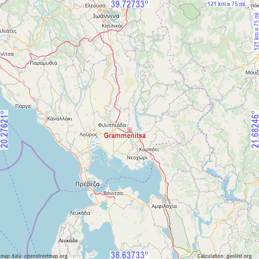
Grammenítsa GPS coordinates[2]
39° 11' 3.984" North, 20° 58' 45.588" East
| Map corner | latitude | longitude |
|---|---|---|
| Upper-left | 39.72733°, | 20.27621° |
| Center: | 39.18444°, | 20.97933° |
| Lower-right: | 38.63733°, | 21.68246° |
| Map W x H: | 121.2×121.2 km | = 75.3×75.3mi |
| max Lat: | 41.72048° ⇑50.5% North |
| Grammenítsa: | 39.18444° |
| min Lat: | ⇓49.5% South 34.8346° |
| min Long | Grammenítsa | max Long |
| 19.40494° | 20.97933° | 29.59361° |
| W 10%⇐ | ⇒90% E |
Elevation
Elevation of Grammenítsa is 48 m = 157 ft, and this is 120.9 m = 397 ft below average elevation for this country.
| Max E: |
1439 m = 4721 ft | 60.6% |
| Avg. | 168.9 m = 554 ft | |
| Grammenítsa | 48 m = 157 ft | |
Min E: |
0 m = 0 ft | 39.4% |
See also: Greece elevation on elevation.city.
Geographical zone
Grammenítsa is located in North temperate zone (between Tropic of Cancer and the Arctic Circle). Distance of this Northern Tropic circle is 1751 km =1088 mi to South.| Distance of | km | miles | from Grammenítsa |
|---|---|---|---|
| North Pole | 5650.2 | 3510.9 | to North |
| Arctic Circle | 3044.3 | 1891.6 | to North |
| Tropic Cancer | 1751 | 1088 | to South |
| Equator | 4356.9 | 2707.3 | to South |


Nearby cities:
15 places around Grammenítsa: (largest is in red/bold)
• Agía Paraskeví
9.6 km =6 mi,  173°
173°
• Ammótopos
10.1 km =6.3 mi,  341°
341°
• Chalkiádes
4.8 km =3 mi,  235°
235°
• Eleoúsa
3.8 km =2.4 mi,  202°
202°
• Filippiáda
8.7 km =5.4 mi,  285°
285°
• Kalamiá
4.6 km =2.9 mi, 242°
• Kalóvatos
8.3 km =5.2 mi,  219°
219°
• Kampí
7.8 km =4.8 mi,  298°
298°
• Kostakioí
5.6 km =3.5 mi, 199°
• Megárchi
9.4 km =5.8 mi,  123°
123°
• Péta
5.2 km =3.2 mi,  112°
112°
• Ráchi
10.4 km =6.5 mi, 221°
• Rókka
3.7 km =2.3 mi, 237°
• Ágioi Anárgyroi
6.4 km =4 mi,  140°
140°
• Árta
2.8 km =1.7 mi, 168°
Sources, notices
• [Note1] Compared only with cities in Greece existing in our database
• [Src1] Map data: © OpenStreetMap contributors (CC-BY-SA)
• [Src2] Other city data from geonames.org with taken over terms of usage.
• [Src3] Geographical zone / Annual Mean Temperature by Robert A. Rohde @ Wikipedia
