Dhervéni geodata
Dhervéni (Peloponnese) is a populated place; located in Greece in Europe/Athens (GMT+3) time zone. With population of 828 people, there are 1232 cities with bigger population in this country. Compared to other cities in Greece, 69.3% of cities are located further ↑North; 62% of cities are located further →East and 86.6% of cities have higher elevation than Dhervéni. Note1
Administrative division(s):
- Level 1: Peloponnese
- Level 2: Nomós Korinthías
- Level 3: Dimos Xylokastro-Evrostina


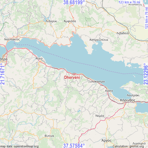
Dhervéni GPS coordinates[2]
38° 7' 51.636" North, 22° 25' 11.388" East
| Map corner | latitude | longitude |
|---|---|---|
| Upper-left | 38.68199°, | 21.71671° |
| Center: | 38.13101°, | 22.41983° |
| Lower-right: | 37.57584°, | 23.12296° |
| Map W x H: | 123×123 km | = 76.4×76.4mi |
| max Lat: | 41.72048° ⇑69.3% North |
| Dhervéni: | 38.13101° |
| min Lat: | ⇓30.7% South 34.8346° |
| min Long | Dhervéni | max Long |
| 19.40494° | 22.41983° | 29.59361° |
| W 38%⇐ | ⇒62% E |
Elevation
Elevation of Dhervéni is 11 m = 36 ft, and this is 157.9 m = 518 ft below average elevation for this country.
| Max E: |
1439 m = 4721 ft | 86.6% |
| Avg. | 168.9 m = 554 ft | |
| Dhervéni | 11 m = 36 ft | |
Min E: |
0 m = 0 ft | 13.4% |
See also: Greece elevation on elevation.city.
Geographical zone
Dhervéni is located in North temperate zone (between Tropic of Cancer and the Arctic Circle). Distance of this Northern Tropic circle is 1633.9 km =1015.3 mi to South.| Distance of | km | miles | from Dhervéni |
|---|---|---|---|
| North Pole | 5767.3 | 3583.6 | to North |
| Arctic Circle | 3161.4 | 1964.4 | to North |
| Tropic Cancer | 1633.9 | 1015.3 | to South |
| Equator | 4239.8 | 2634.5 | to South |


Nearby cities:
15 places around Dhervéni: (largest is in red/bold)
• Akráta
9.3 km =5.8 mi,  286°
286°
• Aíyira
6.1 km =3.8 mi, 288°
• Galaxídhion
28 km =17.4 mi,  352°
352°
• Kalávryta
29.1 km =18.1 mi,  247°
247°
• Kamári
14.8 km =9.2 mi,  106°
106°
• Kariótika Karyás
21.3 km =13.2 mi, 110°
• Krionérion
26.6 km =16.5 mi,  134°
134°
• Káto Dhiminió
29.8 km =18.5 mi, 113°
• Káto Pitsá
10.3 km =6.4 mi,  103°
103°
• Likoporiá
7.6 km =4.7 mi,  92°
92°
• Melíssi
25 km =15.5 mi, 111°
• Rozená
2.3 km =1.4 mi,  237°
237°
• Sylivainiótika
8.4 km =5.2 mi, 293°
• Témeni
28.3 km =17.6 mi, 294°
• Xylókastro
19.5 km =12.1 mi, 107°
Sources, notices
• [Note1] Compared only with cities in Greece existing in our database
• [Src1] Map data: © OpenStreetMap contributors (CC-BY-SA)
• [Src2] Other city data from geonames.org with taken over terms of usage.
• [Src3] Geographical zone / Annual Mean Temperature by Robert A. Rohde @ Wikipedia
