Aíyira geodata
Aíyira (West Greece) is a populated place; located in Greece in Europe/Athens (GMT+3) time zone. With population of 1,462 people, there are 682 cities with bigger population in this country. Compared to other cities in Greece, 69% of cities are located further ↑North; 63.9% of cities are located further →East and 85.7% of cities have higher elevation than Aíyira. Note1


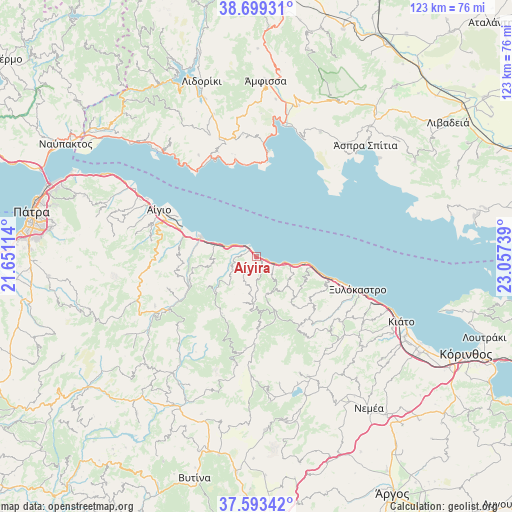
Aíyira GPS coordinates[2]
38° 8' 54.456" North, 22° 21' 15.336" East
| Map corner | latitude | longitude |
|---|---|---|
| Upper-left | 38.69931°, | 21.65114° |
| Center: | 38.14846°, | 22.35426° |
| Lower-right: | 37.59342°, | 23.05739° |
| Map W x H: | 123×123 km | = 76.4×76.4mi |
| max Lat: | 41.72048° ⇑69% North |
| Aíyira: | 38.14846° |
| min Lat: | ⇓31% South 34.8346° |
| min Long | Aíyira | max Long |
| 19.40494° | 22.35426° | 29.59361° |
| W 36.1%⇐ | ⇒63.9% E |
Elevation
Elevation of Aíyira is 12 m = 39 ft, and this is 156.9 m = 515 ft below average elevation for this country.
| Max E: |
1439 m = 4721 ft | 85.7% |
| Avg. | 168.9 m = 554 ft | |
| Aíyira | 12 m = 39 ft | |
Min E: |
0 m = 0 ft | 14.3% |
See also: Greece elevation on elevation.city.
Geographical zone
Aíyira is located in North temperate zone (between Tropic of Cancer and the Arctic Circle). Distance of this Northern Tropic circle is 1635.8 km =1016.4 mi to South.| Distance of | km | miles | from Aíyira |
|---|---|---|---|
| North Pole | 5765.4 | 3582.5 | to North |
| Arctic Circle | 3159.5 | 1963.2 | to North |
| Tropic Cancer | 1635.8 | 1016.4 | to South |
| Equator | 4241.7 | 2635.7 | to South |


Nearby cities:
15 places around Aíyira: (largest is in red/bold)
• Akráta
3.2 km =2 mi,  282°
282°
• Aígio
26.3 km =16.3 mi,  295°
295°
• Dhervéni
6.1 km =3.8 mi,  108°
108°
• Galaxídhion
25.9 km =16.1 mi,  4°
4°
• Kalávryta
24.8 km =15.4 mi,  238°
238°
• Kamári
20.9 km =13 mi, 107°
• Kariótika Karyás
27.3 km =17 mi, 110°
• Káto Pitsá
16.4 km =10.2 mi, 105°
• Likoporiá
13.6 km =8.5 mi,  99°
99°
• Melíssi
31 km =19.3 mi, 111°
• Rododáfni
29.9 km =18.6 mi, 296°
• Rozená
5 km =3.1 mi,  130°
130°
• Sylivainiótika
2.5 km =1.6 mi,  305°
305°
• Témeni
22.3 km =13.9 mi, 296°
• Xylókastro
25.5 km =15.8 mi, 107°
Sources, notices
• [Note1] Compared only with cities in Greece existing in our database
• [Src1] Map data: © OpenStreetMap contributors (CC-BY-SA)
• [Src2] Other city data from geonames.org with taken over terms of usage.
• [Src3] Geographical zone / Annual Mean Temperature by Robert A. Rohde @ Wikipedia
