Almyrós geodata
Almyrós (Thessaly) is a seat of a third-order administrative division; located in Greece in Europe/Athens (GMT+3) time zone. With population of 7,955 people, there are 166 cities with bigger population in this country. Compared to other cities in Greece, 50.6% of cities are located further ↑North; 53.1% of cities are located further →East and 57.4% of cities have higher elevation than Almyrós. Note1


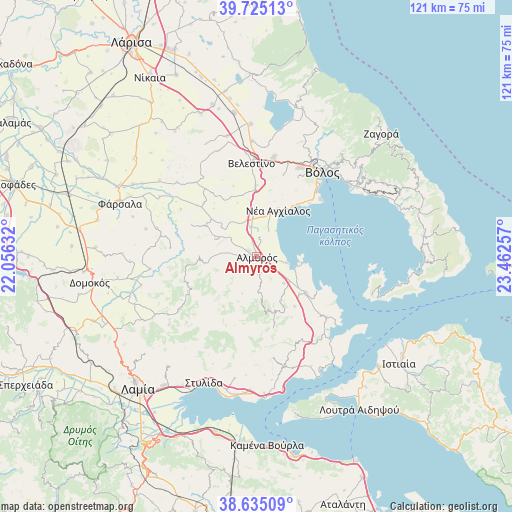
Almyrós GPS coordinates[2]
39° 10' 55.992" North, 22° 45' 33.984" East
| Map corner | latitude | longitude |
|---|---|---|
| Upper-left | 39.72513°, | 22.05632° |
| Center: | 39.18222°, | 22.75944° |
| Lower-right: | 38.63509°, | 23.46257° |
| Map W x H: | 121.2×121.2 km | = 75.3×75.3mi |
| max Lat: | 41.72048° ⇑50.6% North |
| Almyrós: | 39.18222° |
| min Lat: | ⇓49.4% South 34.8346° |
| min Long | Almyrós | max Long |
| 19.40494° | 22.75944° | 29.59361° |
| W 46.9%⇐ | ⇒53.1% E |
Elevation
Elevation of Almyrós is 58 m = 190 ft, and this is 110.9 m = 364 ft below average elevation for this country.
| Max E: |
1439 m = 4721 ft | 57.4% |
| Avg. | 168.9 m = 554 ft | |
| Almyrós | 58 m = 190 ft | |
Min E: |
0 m = 0 ft | 42.6% |
See also: Greece elevation on elevation.city.
Geographical zone
Almyrós is located in North temperate zone (between Tropic of Cancer and the Arctic Circle). Distance of this Northern Tropic circle is 1750.7 km =1087.8 mi to South.| Distance of | km | miles | from Almyrós |
|---|---|---|---|
| North Pole | 5650.4 | 3511 | to North |
| Arctic Circle | 3044.5 | 1891.8 | to North |
| Tropic Cancer | 1750.7 | 1087.8 | to South |
| Equator | 4356.7 | 2707.1 | to South |


Nearby cities:
15 places around Almyrós: (largest is in red/bold)
• Agriá
28 km =17.4 mi,  51°
51°
• Akhíllio
26.2 km =16.3 mi,  138°
138°
• Amaliapolis
10.8 km =6.7 mi,  99°
99°
• Anávra
21.7 km =13.5 mi,  235°
235°
• Evxinoúpolis
1.8 km =1.1 mi,  276°
276°
• Néa Anchiálos
12 km =7.5 mi,  24°
24°
• Néa Ionía
26.2 km =16.3 mi,  33°
33°
• Néos Plátanos
3.7 km =2.3 mi,  126°
126°
• Pelasgía
26.9 km =16.7 mi,  165°
165°
• Pteleós
22 km =13.7 mi, 130°
• Rizómylos
27.3 km =17 mi,  357°
357°
• Soúrpi
14.8 km =9.2 mi, 126°
• Velestíno
22.2 km =13.8 mi, 357°
• Volos
25.4 km =15.8 mi,  38°
38°
• Ágios Geórgios Ferón
20.9 km =13 mi,  4°
4°
Sources, notices
• [Note1] Compared only with cities in Greece existing in our database
• [Src1] Map data: © OpenStreetMap contributors (CC-BY-SA)
• [Src2] Other city data from geonames.org with taken over terms of usage.
• [Src3] Geographical zone / Annual Mean Temperature by Robert A. Rohde @ Wikipedia
