Skýdra geodata
Skýdra (Central Macedonia) is a seat of a third-order administrative division; located in Greece in Europe/Athens (GMT+3) time zone. With population of 4,562 people, there are 256 cities with bigger population in this country. Compared to other cities in Greece, 83.9% of cities are located further ↓South; 68.7% of cities are located further →East and 66.1% of cities have higher elevation than Skýdra. Note1


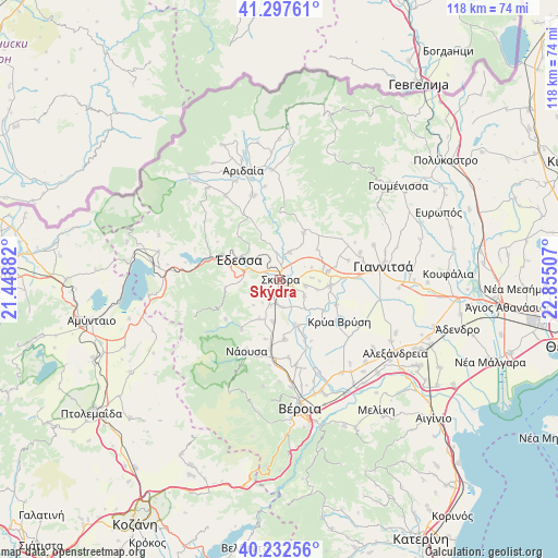
Skýdra GPS coordinates[2]
40° 46' 1.992" North, 22° 9' 6.984" East
| Map corner | latitude | longitude |
|---|---|---|
| Upper-left | 41.29761°, | 21.44882° |
| Center: | 40.76722°, | 22.15194° |
| Lower-right: | 40.23256°, | 22.85507° |
| Map W x H: | 118.4×118.4 km | = 73.6×73.6mi |
| max Lat: | 41.72048° ⇑16.1% North |
| Skýdra: | 40.76722° |
| min Lat: | ⇓83.9% South 34.8346° |
| min Long | Skýdra | max Long |
| 19.40494° | 22.15194° | 29.59361° |
| W 31.3%⇐ | ⇒68.7% E |
Elevation
Elevation of Skýdra is 37 m = 121 ft, and this is 131.9 m = 433 ft below average elevation for this country.
| Max E: |
1439 m = 4721 ft | 66.1% |
| Avg. | 168.9 m = 554 ft | |
| Skýdra | 37 m = 121 ft | |
Min E: |
0 m = 0 ft | 33.9% |
See also: Greece elevation on elevation.city.
Geographical zone
Skýdra is located in North temperate zone (between Tropic of Cancer and the Arctic Circle). Distance of this Northern Tropic circle is 1927 km =1197.4 mi to South.| Distance of | km | miles | from Skýdra |
|---|---|---|---|
| North Pole | 5474.2 | 3401.5 | to North |
| Arctic Circle | 2868.3 | 1782.3 | to North |
| Tropic Cancer | 1927 | 1197.4 | to South |
| Equator | 4532.9 | 2816.6 | to South |


Nearby cities:
15 places around Skýdra: (largest is in red/bold)
• Arsénio
5.9 km =3.7 mi,  174°
174°
• Episkopí
9 km =5.6 mi,  188°
188°
• Kallípoli
7.3 km =4.5 mi,  69°
69°
• Kalí
6.2 km =3.9 mi,  20°
20°
• Kalývia
5.7 km =3.5 mi,  103°
103°
• Káto Lipochóri
2.6 km =1.6 mi,  114°
114°
• Liparó
8.4 km =5.2 mi, 105°
• Mavrovoúni
1.7 km =1.1 mi,  12°
12°
• Petraía
5.3 km =3.3 mi, 186°
• Profítis Ilías
5.2 km =3.2 mi, 8°
• Rizári
5.7 km =3.5 mi,  288°
288°
• Rizó
4 km =2.5 mi,  198°
198°
• Sevastianá
2.4 km =1.5 mi,  274°
274°
• Stavrodrómi
8.3 km =5.2 mi,  138°
138°
• Áspro
6.4 km =4 mi,  123°
123°
Sources, notices
• [Note1] Compared only with cities in Greece existing in our database
• [Src1] Map data: © OpenStreetMap contributors (CC-BY-SA)
• [Src2] Other city data from geonames.org with taken over terms of usage.
• [Src3] Geographical zone / Annual Mean Temperature by Robert A. Rohde @ Wikipedia
