Áspro geodata
Áspro (Central Macedonia) is a populated place; located in Greece in Europe/Athens (GMT+3) time zone. With population of 851 people, there are 1196 cities with bigger population in this country. Compared to other cities in Greece, 82.6% of cities are located further ↓South; 67% of cities are located further →East and 80.3% of cities have higher elevation than Áspro. Note1


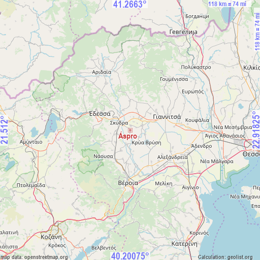
Áspro GPS coordinates[2]
40° 44' 8.376" North, 22° 12' 54.432" East
| Map corner | latitude | longitude |
|---|---|---|
| Upper-left | 41.2663°, | 21.512° |
| Center: | 40.73566°, | 22.21512° |
| Lower-right: | 40.20075°, | 22.91825° |
| Map W x H: | 118.5×118.5 km | = 73.6×73.6mi |
| max Lat: | 41.72048° ⇑17.4% North |
| Áspro: | 40.73566° |
| min Lat: | ⇓82.6% South 34.8346° |
| min Long | Áspro | max Long |
| 19.40494° | 22.21512° | 29.59361° |
| W 33%⇐ | ⇒67% E |
Elevation
Elevation of Áspro is 17 m = 56 ft, and this is 151.9 m = 498 ft below average elevation for this country.
| Max E: |
1439 m = 4721 ft | 80.3% |
| Avg. | 168.9 m = 554 ft | |
| Áspro | 17 m = 56 ft | |
Min E: |
0 m = 0 ft | 19.7% |
See also: Greece elevation on elevation.city.
Geographical zone
Áspro is located in North temperate zone (between Tropic of Cancer and the Arctic Circle). Distance of this Northern Tropic circle is 1923.5 km =1195.2 mi to South.| Distance of | km | miles | from Áspro |
|---|---|---|---|
| North Pole | 5477.7 | 3403.7 | to North |
| Arctic Circle | 2871.8 | 1784.5 | to North |
| Tropic Cancer | 1923.5 | 1195.2 | to South |
| Equator | 4529.4 | 2814.4 | to South |


Nearby cities:
15 places around Áspro: (largest is in red/bold)
• Angelochóri
6.5 km =4 mi,  191°
191°
• Arsénio
5.3 km =3.3 mi,  243°
243°
• Eirinoúpoli
6.7 km =4.2 mi,  196°
196°
• Esóvalta
5.2 km =3.2 mi,  127°
127°
• Galatádes
6 km =3.7 mi,  67°
67°
• Kallípoli
6.2 km =3.9 mi,  14°
14°
• Kalývia
2.2 km =1.4 mi, 5°
• Káto Lipochóri
3.9 km =2.4 mi,  309°
309°
• Liparó
3 km =1.9 mi, 65°
• Petraía
6.2 km =3.9 mi,  253°
253°
• Polyplátanos
6.2 km =3.9 mi, 199°
• Rizó
6.6 km =4.1 mi,  267°
267°
• Skýdra
6.4 km =4 mi,  303°
303°
• Stavrodrómi
2.7 km =1.7 mi,  176°
176°
• Ágios Loukás
7 km =4.3 mi,  106°
106°
Sources, notices
• [Note1] Compared only with cities in Greece existing in our database
• [Src1] Map data: © OpenStreetMap contributors (CC-BY-SA)
• [Src2] Other city data from geonames.org with taken over terms of usage.
• [Src3] Geographical zone / Annual Mean Temperature by Robert A. Rohde @ Wikipedia
