Pylaía geodata
Pylaía (Central Macedonia) is a populated place; located in Greece in Europe/Athens (GMT+3) time zone. With population of 23,494 people, there are 80 cities with bigger population in this country. Compared to other cities in Greece, 77.6% of cities are located further ↓South; 54.4% of cities are located further ←West and 52.3% of cities have lower elevation than Pylaía. Note1
Administrative division(s):
- Level 1: Central Macedonia
- Level 2: Nomós Thessaloníkis
- Level 3: Dimos Pylaia-Chortiatis


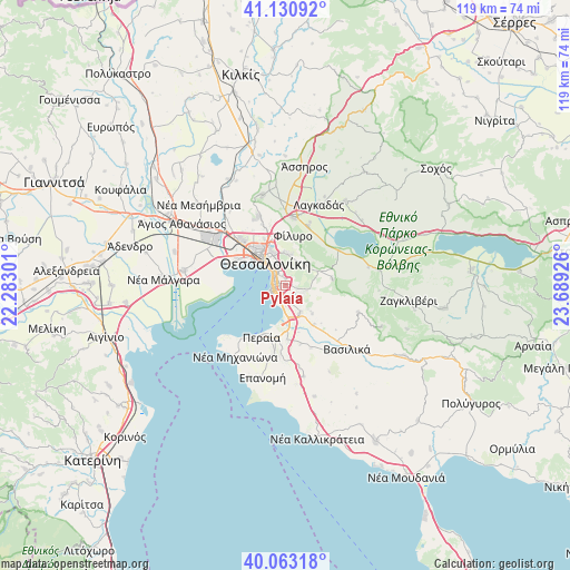
Pylaía GPS coordinates[2]
40° 35' 57.048" North, 22° 59' 10.068" East
| Map corner | latitude | longitude |
|---|---|---|
| Upper-left | 41.13092°, | 22.28301° |
| Center: | 40.59918°, | 22.98613° |
| Lower-right: | 40.06318°, | 23.68926° |
| Map W x H: | 118.7×118.7 km | = 73.8×73.8mi |
| max Lat: | 41.72048° ⇑22.4% North |
| Pylaía: | 40.59918° |
| min Lat: | ⇓77.6% South 34.8346° |
| min Long | Pylaía | max Long |
| 19.40494° | 22.98613° | 29.59361° |
| W 54.4%⇐ | ⇒45.6% E |
Elevation
Elevation of Pylaía is 90 m = 295 ft, and this is 78.9 m = 259 ft below average elevation for this country.
| Max E: |
1439 m = 4721 ft | 47.7% |
| Avg. | 168.9 m = 554 ft | |
| Pylaía | 90 m = 295 ft | |
Min E: |
0 m = 0 ft | 52.3% |
See also: Greece elevation on elevation.city.
Geographical zone
Pylaía is located in North temperate zone (between Tropic of Cancer and the Arctic Circle). Distance of this Northern Tropic circle is 1908.3 km =1185.8 mi to South.| Distance of | km | miles | from Pylaía |
|---|---|---|---|
| North Pole | 5492.9 | 3413.1 | to North |
| Arctic Circle | 2887 | 1793.9 | to North |
| Tropic Cancer | 1908.3 | 1185.8 | to South |
| Equator | 4514.2 | 2805 | to South |


Nearby cities:
15 places around Pylaía: (largest is in red/bold)
• Ampelókipoi
7.8 km =4.8 mi,  319°
319°
• Asvestochóri
5.7 km =3.5 mi,  35°
35°
• Chortiátis
9.7 km =6 mi,  83°
83°
• Kalamariá
3.5 km =2.2 mi,  238°
238°
• Meneméni
10 km =6.2 mi,  311°
311°
• Neapoli
7.1 km =4.4 mi,  327°
327°
• Panórama
4 km =2.5 mi,  108°
108°
• Políchni
8.1 km =5 mi,  337°
337°
• Péfka
6.6 km =4.1 mi,  5°
5°
• Stavroúpoli
8.8 km =5.5 mi, 332°
• Sykiés
6.3 km =3.9 mi, 331°
• Thessaloníki
6.8 km =4.2 mi, 316°
• Thérmi
6.4 km =4 mi,  153°
153°
• Triandría
1.9 km =1.2 mi, 334°
• Ágios Pávlos
5.1 km =3.2 mi, 334°
Sources, notices
• [Note1] Compared only with cities in Greece existing in our database
• [Src1] Map data: © OpenStreetMap contributors (CC-BY-SA)
• [Src2] Other city data from geonames.org with taken over terms of usage.
• [Src3] Geographical zone / Annual Mean Temperature by Robert A. Rohde @ Wikipedia
