Mesiméri geodata
Mesiméri (Central Macedonia) is a populated place; located in Greece in Europe/Athens (GMT+3) time zone. With population of 899 people, there are 1131 cities with bigger population in this country. Compared to other cities in Greece, 85.1% of cities are located further ↓South; 71.6% of cities are located further →East and 87.1% of cities have lower elevation than Mesiméri. Note1


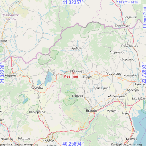
Mesiméri GPS coordinates[2]
40° 47' 36.204" North, 22° 1' 31.44" East
| Map corner | latitude | longitude |
|---|---|---|
| Upper-left | 41.32357°, | 21.32228° |
| Center: | 40.79339°, | 22.0254° |
| Lower-right: | 40.25894°, | 22.72853° |
| Map W x H: | 118.4×118.4 km | = 73.6×73.6mi |
| max Lat: | 41.72048° ⇑14.9% North |
| Mesiméri: | 40.79339° |
| min Lat: | ⇓85.1% South 34.8346° |
| min Long | Mesiméri | max Long |
| 19.40494° | 22.0254° | 29.59361° |
| W 28.4%⇐ | ⇒71.6% E |
Elevation
Elevation of Mesiméri is 437 m = 1434 ft, and this is 268.1 m = 880 ft above average elevation for this country.
| Max E: |
1439 m = 4721 ft | 12.9% |
| Mesiméri | 437 m 1434 ft | |
| Avg. | 168.9 m = 554 ft | |
Min E: |
0 m = 0 ft | 87.1% |
See also: Greece elevation on elevation.city.
Geographical zone
Mesiméri is located in North temperate zone (between Tropic of Cancer and the Arctic Circle). Distance of this Northern Tropic circle is 1929.9 km =1199.2 mi to South.| Distance of | km | miles | from Mesiméri |
|---|---|---|---|
| North Pole | 5471.3 | 3399.7 | to North |
| Arctic Circle | 2865.4 | 1780.5 | to North |
| Tropic Cancer | 1929.9 | 1199.2 | to South |
| Equator | 4535.8 | 2818.4 | to South |


Nearby cities:
15 places around Mesiméri: (largest is in red/bold)
• Flamouriá
4.6 km =2.9 mi,  188°
188°
• Kalí
13.1 km =8.1 mi,  77°
77°
• Káto Lipochóri
13.6 km =8.5 mi,  107°
107°
• Marína
12.9 km =8 mi,  150°
150°
• Mavrovoúni
11.1 km =6.9 mi,  96°
96°
• Petraía
12.9 km =8 mi,  129°
129°
• Profítis Ilías
11.7 km =7.3 mi, 78°
• Rizári
5.4 km =3.4 mi, 101°
• Rizó
11.5 km =7.1 mi, 125°
• Rodochóri
11.4 km =7.1 mi,  183°
183°
• Sevastianá
8.7 km =5.4 mi, 108°
• Skýdra
11 km =6.8 mi, 105°
• Ágras
2.3 km =1.4 mi,  306°
306°
• Ápsalos
11.3 km =7 mi,  13°
13°
• Édessa
2.1 km =1.3 mi,  61°
61°
Sources, notices
• [Note1] Compared only with cities in Greece existing in our database
• [Src1] Map data: © OpenStreetMap contributors (CC-BY-SA)
• [Src2] Other city data from geonames.org with taken over terms of usage.
• [Src3] Geographical zone / Annual Mean Temperature by Robert A. Rohde @ Wikipedia
