Rodochóri geodata
Rodochóri (Central Macedonia) is a populated place; located in Greece in Europe/Athens (GMT+3) time zone. With population of 623 people, there are 1539 cities with bigger population in this country. Compared to other cities in Greece, 81.2% of cities are located further ↓South; 71.8% of cities are located further →East and 91% of cities have lower elevation than Rodochóri. Note1
Administrative division(s):
- Level 1: Central Macedonia
- Level 2: Nomós Imathías
- Level 3: Dimos Naousa


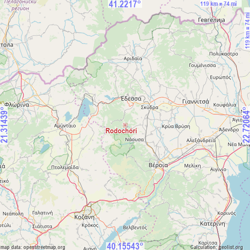
Rodochóri GPS coordinates[2]
40° 41' 26.52" North, 22° 1' 3.036" East
| Map corner | latitude | longitude |
|---|---|---|
| Upper-left | 41.2217°, | 21.31439° |
| Center: | 40.6907°, | 22.01751° |
| Lower-right: | 40.15543°, | 22.72064° |
| Map W x H: | 118.6×118.6 km | = 73.7×73.7mi |
| max Lat: | 41.72048° ⇑18.8% North |
| Rodochóri: | 40.6907° |
| min Lat: | ⇓81.2% South 34.8346° |
| min Long | Rodochóri | max Long |
| 19.40494° | 22.01751° | 29.59361° |
| W 28.2%⇐ | ⇒71.8% E |
Elevation
Elevation of Rodochóri is 532 m = 1745 ft, and this is 363.1 m = 1191 ft above average elevation for this country.
| Max E: |
1439 m = 4721 ft | 9% |
| Rodochóri | 532 m 1745 ft | |
| Avg. | 168.9 m = 554 ft | |
Min E: |
0 m = 0 ft | 91% |
See also: Greece elevation on elevation.city.
Geographical zone
Rodochóri is located in North temperate zone (between Tropic of Cancer and the Arctic Circle). Distance of this Northern Tropic circle is 1918.5 km =1192.1 mi to South.| Distance of | km | miles | from Rodochóri |
|---|---|---|---|
| North Pole | 5482.7 | 3406.8 | to North |
| Arctic Circle | 2876.8 | 1787.6 | to North |
| Tropic Cancer | 1918.5 | 1192.1 | to South |
| Equator | 4524.4 | 2811.3 | to South |


Nearby cities:
15 places around Rodochóri: (largest is in red/bold)
• Arsénio
12.2 km =7.6 mi,  77°
77°
• Charíessa
13.3 km =8.3 mi,  109°
109°
• Episkopí
10 km =6.2 mi,  92°
92°
• Flamouriá
6.9 km =4.3 mi,  359°
359°
• Kopanós
11.3 km =7 mi,  123°
123°
• Lefkádia
9.5 km =5.9 mi, 116°
• Marína
7 km =4.3 mi, 88°
• Mesiméri
11.4 km =7.1 mi,  3°
3°
• Náousa
8 km =5 mi,  147°
147°
• Petraía
11.2 km =7 mi,  72°
72°
• Rizári
11.9 km =7.4 mi,  29°
29°
• Rizó
11.1 km =6.9 mi,  64°
64°
• Sevastianá
12.4 km =7.7 mi,  45°
45°
• Ágras
12.8 km =8 mi,  354°
354°
• Édessa
12.7 km =7.9 mi,  11°
11°
Sources, notices
• [Note1] Compared only with cities in Greece existing in our database
• [Src1] Map data: © OpenStreetMap contributors (CC-BY-SA)
• [Src2] Other city data from geonames.org with taken over terms of usage.
• [Src3] Geographical zone / Annual Mean Temperature by Robert A. Rohde @ Wikipedia
