Pentálofos geodata
Pentálofos (Central Macedonia) is a populated place; located in Greece in Europe/Athens (GMT+3) time zone. With population of 2,107 people, there are 491 cities with bigger population in this country. Compared to other cities in Greece, 82.7% of cities are located further ↓South; 50.1% of cities are located further →East and 60.8% of cities have lower elevation than Pentálofos. Note1
Administrative division(s):
- Level 1: Central Macedonia
- Level 2: Nomós Thessaloníkis
- Level 3: Dimos Oraiokastro


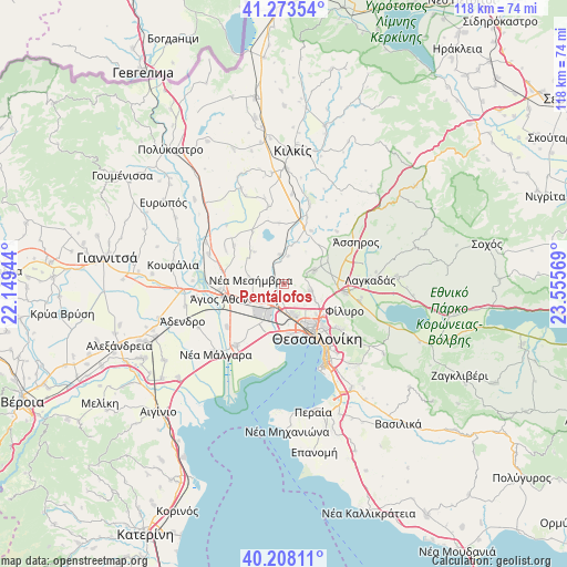
Pentálofos GPS coordinates[2]
40° 44' 34.656" North, 22° 51' 9.216" East
| Map corner | latitude | longitude |
|---|---|---|
| Upper-left | 41.27354°, | 22.14944° |
| Center: | 40.74296°, | 22.85256° |
| Lower-right: | 40.20811°, | 23.55569° |
| Map W x H: | 118.5×118.5 km | = 73.6×73.6mi |
| max Lat: | 41.72048° ⇑17.3% North |
| Pentálofos: | 40.74296° |
| min Lat: | ⇓82.7% South 34.8346° |
| min Long | Pentálofos | max Long |
| 19.40494° | 22.85256° | 29.59361° |
| W 49.9%⇐ | ⇒50.1% E |
Elevation
Elevation of Pentálofos is 120 m = 394 ft, and this is 48.9 m = 160 ft below average elevation for this country.
| Max E: |
1439 m = 4721 ft | 39.2% |
| Avg. | 168.9 m = 554 ft | |
| Pentálofos | 120 m = 394 ft | |
Min E: |
0 m = 0 ft | 60.8% |
See also: Greece elevation on elevation.city.
Geographical zone
Pentálofos is located in North temperate zone (between Tropic of Cancer and the Arctic Circle). Distance of this Northern Tropic circle is 1924.3 km =1195.7 mi to South.| Distance of | km | miles | from Pentálofos |
|---|---|---|---|
| North Pole | 5476.9 | 3403.2 | to North |
| Arctic Circle | 2871 | 1784 | to North |
| Tropic Cancer | 1924.3 | 1195.7 | to South |
| Equator | 4530.2 | 2814.9 | to South |


Nearby cities:
15 places around Pentálofos: (largest is in red/bold)
• Anchíalos
6.8 km =4.2 mi,  243°
243°
• Diavatá
6.2 km =3.9 mi,  175°
175°
• Drymós
9.9 km =6.2 mi,  64°
64°
• Efkarpía
10.5 km =6.5 mi,  125°
125°
• Lití
10.7 km =6.6 mi,  88°
88°
• Melissochóri
7 km =4.3 mi,  66°
66°
• Meneméni
10.1 km =6.3 mi,  158°
158°
• Neochoroúda
2 km =1.2 mi,  105°
105°
• Néa Filadélfeia
6.2 km =3.9 mi,  350°
350°
• Néa Magnisía
6.2 km =3.9 mi,  185°
185°
• Néa Mesimvría
7.1 km =4.4 mi,  277°
277°
• Oraiókastro
5.6 km =3.5 mi,  103°
103°
• Síndos
9 km =5.6 mi,  206°
206°
• Xirochóri
9.1 km =5.7 mi,  317°
317°
• Évosmos
9.3 km =5.8 mi,  149°
149°
Sources, notices
• [Note1] Compared only with cities in Greece existing in our database
• [Src1] Map data: © OpenStreetMap contributors (CC-BY-SA)
• [Src2] Other city data from geonames.org with taken over terms of usage.
• [Src3] Geographical zone / Annual Mean Temperature by Robert A. Rohde @ Wikipedia
