Episkopí geodata
Episkopí (Central Macedonia) is a populated place; located in Greece in Europe/Athens (GMT+3) time zone. With population of 668 people, there are 1466 cities with bigger population in this country. Compared to other cities in Greece, 77.3% of cities are located further ↓South; 63.7% of cities are located further →East and 87.7% of cities have higher elevation than Episkopí. Note1
Administrative division(s):
- Level 1: Central Macedonia
- Level 2: Nomós Imathías
- Level 3: Dimos Alexandreia


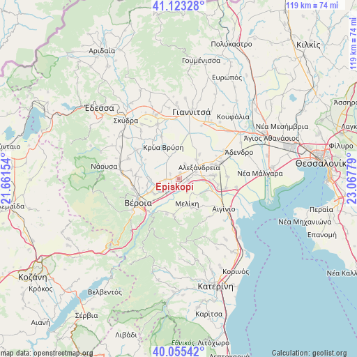
Episkopí GPS coordinates[2]
40° 35' 29.328" North, 22° 21' 52.776" East
| Map corner | latitude | longitude |
|---|---|---|
| Upper-left | 41.12328°, | 21.66154° |
| Center: | 40.59148°, | 22.36466° |
| Lower-right: | 40.05542°, | 23.06779° |
| Map W x H: | 118.7×118.7 km | = 73.8×73.8mi |
| max Lat: | 41.72048° ⇑22.7% North |
| Episkopí: | 40.59148° |
| min Lat: | ⇓77.3% South 34.8346° |
| min Long | Episkopí | max Long |
| 19.40494° | 22.36466° | 29.59361° |
| W 36.3%⇐ | ⇒63.7% E |
Elevation
Elevation of Episkopí is 10 m = 33 ft, and this is 158.9 m = 521 ft below average elevation for this country.
| Max E: |
1439 m = 4721 ft | 87.7% |
| Avg. | 168.9 m = 554 ft | |
| Episkopí | 10 m = 33 ft | |
Min E: |
0 m = 0 ft | 12.3% |
See also: Greece elevation on elevation.city.
Geographical zone
Episkopí is located in North temperate zone (between Tropic of Cancer and the Arctic Circle). Distance of this Northern Tropic circle is 1907.4 km =1185.2 mi to South.| Distance of | km | miles | from Episkopí |
|---|---|---|---|
| North Pole | 5493.7 | 3413.6 | to North |
| Arctic Circle | 2887.8 | 1794.4 | to North |
| Tropic Cancer | 1907.4 | 1185.2 | to South |
| Equator | 4513.3 | 2804.4 | to South |


Nearby cities:
15 places around Episkopí: (largest is in red/bold)
• Alexándreia
7.8 km =4.8 mi,  59°
59°
• Diavatós
9.7 km =6 mi,  238°
238°
• Kampochóri
2 km =1.2 mi,  11°
11°
• Kavásila
2.8 km =1.7 mi,  269°
269°
• Kefalochóri
2.5 km =1.6 mi,  177°
177°
• Kouloúra
6.4 km =4 mi,  218°
218°
• Loutrós
3 km =1.9 mi,  95°
95°
• Melíki
8.7 km =5.4 mi,  162°
162°
• Niséli
8.1 km =5 mi,  87°
87°
• Nisí
5.4 km =3.4 mi,  22°
22°
• Palaió Skyllítsi
3.4 km =2.1 mi,  298°
298°
• Pródromos
5.3 km =3.3 mi,  149°
149°
• Stavrós
4.7 km =2.9 mi, 267°
• Vrysáki
4.6 km =2.9 mi,  45°
45°
• Xechasméni
3.3 km =2.1 mi, 220°
Sources, notices
• [Note1] Compared only with cities in Greece existing in our database
• [Src1] Map data: © OpenStreetMap contributors (CC-BY-SA)
• [Src2] Other city data from geonames.org with taken over terms of usage.
• [Src3] Geographical zone / Annual Mean Temperature by Robert A. Rohde @ Wikipedia
