Mavrothálassa geodata
Mavrothálassa (Central Macedonia) is a populated place; located in Greece in Europe/Athens (GMT+3) time zone. With population of 1,572 people, there are 628 cities with bigger population in this country. Compared to other cities in Greece, 88.3% of cities are located further ↓South; 71.5% of cities are located further ←West and 74.9% of cities have higher elevation than Mavrothálassa. Note1
Administrative division(s):
- Level 1: Central Macedonia
- Level 2: Nomós Serrón
- Level 3: Dimos Visaltia


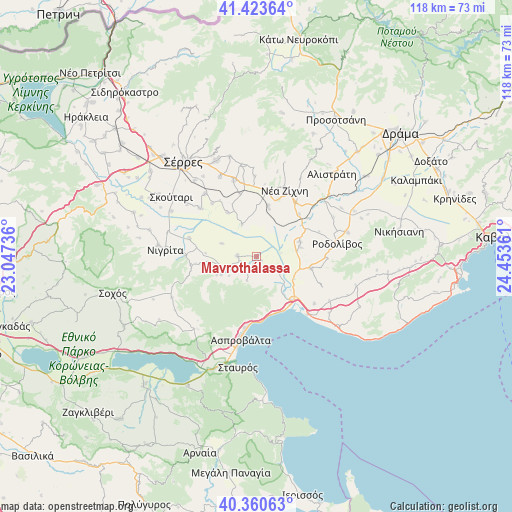
Mavrothálassa GPS coordinates[2]
40° 53' 39.372" North, 23° 45' 1.728" East
| Map corner | latitude | longitude |
|---|---|---|
| Upper-left | 41.42364°, | 23.04736° |
| Center: | 40.89427°, | 23.75048° |
| Lower-right: | 40.36063°, | 24.45361° |
| Map W x H: | 118.2×118.2 km | = 73.4×73.4mi |
| max Lat: | 41.72048° ⇑11.7% North |
| Mavrothálassa: | 40.89427° |
| min Lat: | ⇓88.3% South 34.8346° |
| min Long | Mavrothálassa | max Long |
| 19.40494° | 23.75048° | 29.59361° |
| W 71.5%⇐ | ⇒28.5% E |
Elevation
Elevation of Mavrothálassa is 24 m = 79 ft, and this is 144.9 m = 475 ft below average elevation for this country.
| Max E: |
1439 m = 4721 ft | 74.9% |
| Avg. | 168.9 m = 554 ft | |
| Mavrothálassa | 24 m = 79 ft | |
Min E: |
0 m = 0 ft | 25.1% |
See also: Greece elevation on elevation.city.
Geographical zone
Mavrothálassa is located in North temperate zone (between Tropic of Cancer and the Arctic Circle). Distance of this Northern Tropic circle is 1941.1 km =1206.1 mi to South.| Distance of | km | miles | from Mavrothálassa |
|---|---|---|---|
| North Pole | 5460 | 3392.7 | to North |
| Arctic Circle | 2854.2 | 1773.5 | to North |
| Tropic Cancer | 1941.1 | 1206.1 | to South |
| Equator | 4547 | 2825.4 | to South |


Nearby cities:
15 places around Mavrothálassa: (largest is in red/bold)
• Achinós
8.4 km =5.2 mi,  290°
290°
• Dravískos
10.7 km =6.6 mi,  71°
71°
• Efkarpía
3.9 km =2.4 mi,  152°
152°
• Flámpouro
16 km =9.9 mi,  284°
284°
• Gázoros
14.8 km =9.2 mi,  8°
8°
• Mavrólofos
10.4 km =6.5 mi,  78°
78°
• Néa Kerdýlia
13.5 km =8.4 mi, 145°
• Néa Zíchni
16.7 km =10.4 mi,  23°
23°
• Palaiokómi
12.9 km =8 mi,  101°
101°
• Paralímnio
12.1 km =7.5 mi,  326°
326°
• Psychikó
15.9 km =9.9 mi,  320°
320°
• Sitochóri
11.2 km =7 mi,  262°
262°
• Tholós
12 km =7.5 mi, 12°
• Toúmpa
14.9 km =9.3 mi,  345°
345°
• Ívira
4.4 km =2.7 mi,  271°
271°
Sources, notices
• [Note1] Compared only with cities in Greece existing in our database
• [Src1] Map data: © OpenStreetMap contributors (CC-BY-SA)
• [Src2] Other city data from geonames.org with taken over terms of usage.
• [Src3] Geographical zone / Annual Mean Temperature by Robert A. Rohde @ Wikipedia
