Levaía geodata
Levaía (West Macedonia) is a populated place; located in Greece in Europe/Athens (GMT+3) time zone. With population of 919 people, there are 1106 cities with bigger population in this country. Compared to other cities in Greece, 79.3% of cities are located further ↓South; 78.3% of cities are located further →East and 93.9% of cities have lower elevation than Levaía. Note1


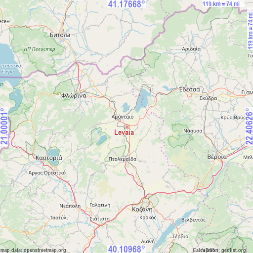
Levaía GPS coordinates[2]
40° 38' 43.116" North, 21° 42' 11.268" East
| Map corner | latitude | longitude |
|---|---|---|
| Upper-left | 41.17668°, | 21.00001° |
| Center: | 40.64531°, | 21.70313° |
| Lower-right: | 40.10968°, | 22.40626° |
| Map W x H: | 118.6×118.6 km | = 73.7×73.7mi |
| max Lat: | 41.72048° ⇑20.7% North |
| Levaía: | 40.64531° |
| min Lat: | ⇓79.3% South 34.8346° |
| min Long | Levaía | max Long |
| 19.40494° | 21.70313° | 29.59361° |
| W 21.7%⇐ | ⇒78.3% E |
Elevation
Elevation of Levaía is 631 m = 2070 ft, and this is 462.1 m = 1516 ft above average elevation for this country.
| Max E: |
1439 m = 4721 ft | 6.1% |
| Levaía | 631 m 2070 ft | |
| Avg. | 168.9 m = 554 ft | |
Min E: |
0 m = 0 ft | 93.9% |
See also: Greece elevation on elevation.city.
Geographical zone
Levaía is located in North temperate zone (between Tropic of Cancer and the Arctic Circle). Distance of this Northern Tropic circle is 1913.4 km =1188.9 mi to South.| Distance of | km | miles | from Levaía |
|---|---|---|---|
| North Pole | 5487.7 | 3409.9 | to North |
| Arctic Circle | 2881.8 | 1790.7 | to North |
| Tropic Cancer | 1913.4 | 1188.9 | to South |
| Equator | 4519.3 | 2808.2 | to South |


Nearby cities:
15 places around Levaía: (largest is in red/bold)
• Aetós
12.7 km =7.9 mi,  277°
277°
• Amýntaio
5.3 km =3.3 mi,  338°
338°
• Anatolikó
11.8 km =7.3 mi,  161°
161°
• Análipsi
6 km =3.7 mi, 343°
• Filótas
2.3 km =1.4 mi,  168°
168°
• Komniná
8.7 km =5.4 mi,  134°
134°
• Kélli
15.8 km =9.8 mi,  355°
355°
• Léchovo
19 km =11.8 mi,  249°
249°
• Ptolemaḯda
14.7 km =9.1 mi,  188°
188°
• Sklíthro
16.9 km =10.5 mi,  261°
261°
• Vévi
15.4 km =9.6 mi,  331°
331°
• Xinó Neró
8.4 km =5.2 mi,  306°
306°
• Ágios Panteleímonas
9.5 km =5.9 mi,  23°
23°
• Árdassa
19.6 km =12.2 mi,  197°
197°
• Árnissa
20.1 km =12.5 mi,  33°
33°
Sources, notices
• [Note1] Compared only with cities in Greece existing in our database
• [Src1] Map data: © OpenStreetMap contributors (CC-BY-SA)
• [Src2] Other city data from geonames.org with taken over terms of usage.
• [Src3] Geographical zone / Annual Mean Temperature by Robert A. Rohde @ Wikipedia
