Anatolikó geodata
Anatolikó (West Macedonia) is a populated place; located in Greece in Europe/Athens (GMT+3) time zone. With population of 959 people, there are 1062 cities with bigger population in this country. Compared to other cities in Greece, 75.8% of cities are located further ↓South; 77.4% of cities are located further →East and 94.2% of cities have lower elevation than Anatolikó. Note1


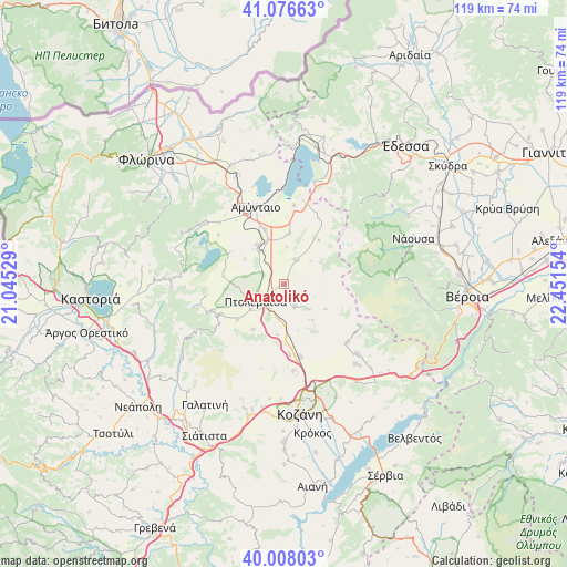
Anatolikó GPS coordinates[2]
40° 32' 40.056" North, 21° 44' 54.276" East
| Map corner | latitude | longitude |
|---|---|---|
| Upper-left | 41.07663°, | 21.04529° |
| Center: | 40.54446°, | 21.74841° |
| Lower-right: | 40.00803°, | 22.45154° |
| Map W x H: | 118.8×118.8 km | = 73.8×73.8mi |
| max Lat: | 41.72048° ⇑24.2% North |
| Anatolikó: | 40.54446° |
| min Lat: | ⇓75.8% South 34.8346° |
| min Long | Anatolikó | max Long |
| 19.40494° | 21.74841° | 29.59361° |
| W 22.6%⇐ | ⇒77.4% E |
Elevation
Elevation of Anatolikó is 635 m = 2083 ft, and this is 466.1 m = 1529 ft above average elevation for this country.
| Max E: |
1439 m = 4721 ft | 5.8% |
| Anatolikó | 635 m 2083 ft | |
| Avg. | 168.9 m = 554 ft | |
Min E: |
0 m = 0 ft | 94.2% |
See also: Greece elevation on elevation.city.
Geographical zone
Anatolikó is located in North temperate zone (between Tropic of Cancer and the Arctic Circle). Distance of this Northern Tropic circle is 1902.2 km =1182 mi to South.| Distance of | km | miles | from Anatolikó |
|---|---|---|---|
| North Pole | 5498.9 | 3416.9 | to North |
| Arctic Circle | 2893.1 | 1797.7 | to North |
| Tropic Cancer | 1902.2 | 1182 | to South |
| Equator | 4508.1 | 2801.2 | to South |


Nearby cities:
15 places around Anatolikó: (largest is in red/bold)
• Aetós
20.9 km =13 mi,  308°
308°
• Akriní
18.1 km =11.2 mi,  132°
132°
• Amýntaio
17.2 km =10.7 mi,  340°
340°
• Anaráchi
15.9 km =9.9 mi,  248°
248°
• Análipsi
17.8 km =11.1 mi, 341°
• Empório
17.3 km =10.7 mi, 248°
• Filótas
9.6 km =6 mi, 339°
• Kleítos
15.6 km =9.7 mi,  143°
143°
• Komniná
5.7 km =3.5 mi,  24°
24°
• Levaía
11.8 km =7.3 mi, 341°
• Ptolemaḯda
6.8 km =4.2 mi,  240°
240°
• Varikó
20.7 km =12.9 mi,  268°
268°
• Xinó Neró
19.4 km =12.1 mi,  326°
326°
• Ágios Panteleímonas
20 km =12.4 mi,  359°
359°
• Árdassa
12.2 km =7.6 mi,  232°
232°
Sources, notices
• [Note1] Compared only with cities in Greece existing in our database
• [Src1] Map data: © OpenStreetMap contributors (CC-BY-SA)
• [Src2] Other city data from geonames.org with taken over terms of usage.
• [Src3] Geographical zone / Annual Mean Temperature by Robert A. Rohde @ Wikipedia
