Komniná geodata
Komniná (West Macedonia) is a populated place; located in Greece in Europe/Athens (GMT+3) time zone. With population of 1,126 people, there are 896 cities with bigger population in this country. Compared to other cities in Greece, 77.2% of cities are located further ↓South; 76.9% of cities are located further →East and 95.5% of cities have lower elevation than Komniná. Note1


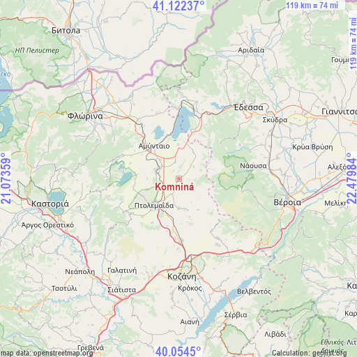
Komniná GPS coordinates[2]
40° 35' 26.052" North, 21° 46' 36.156" East
| Map corner | latitude | longitude |
|---|---|---|
| Upper-left | 41.12237°, | 21.07359° |
| Center: | 40.59057°, | 21.77671° |
| Lower-right: | 40.0545°, | 22.47984° |
| Map W x H: | 118.7×118.7 km | = 73.8×73.8mi |
| max Lat: | 41.72048° ⇑22.8% North |
| Komniná: | 40.59057° |
| min Lat: | ⇓77.2% South 34.8346° |
| min Long | Komniná | max Long |
| 19.40494° | 21.77671° | 29.59361° |
| W 23.1%⇐ | ⇒76.9% E |
Elevation
Elevation of Komniná is 683 m = 2241 ft, and this is 514.1 m = 1687 ft above average elevation for this country.
| Max E: |
1439 m = 4721 ft | 4.5% |
| Komniná | 683 m 2241 ft | |
| Avg. | 168.9 m = 554 ft | |
Min E: |
0 m = 0 ft | 95.5% |
See also: Greece elevation on elevation.city.
Geographical zone
Komniná is located in North temperate zone (between Tropic of Cancer and the Arctic Circle). Distance of this Northern Tropic circle is 1907.3 km =1185.1 mi to South.| Distance of | km | miles | from Komniná |
|---|---|---|---|
| North Pole | 5493.8 | 3413.7 | to North |
| Arctic Circle | 2887.9 | 1794.5 | to North |
| Tropic Cancer | 1907.3 | 1185.1 | to South |
| Equator | 4513.2 | 2804.4 | to South |


Nearby cities:
15 places around Komniná: (largest is in red/bold)
• Aetós
20.4 km =12.7 mi,  292°
292°
• Akriní
20.5 km =12.7 mi,  147°
147°
• Amýntaio
13.7 km =8.5 mi,  323°
323°
• Anaráchi
20.4 km =12.7 mi,  237°
237°
• Anatolikó
5.7 km =3.5 mi,  204°
204°
• Análipsi
14.2 km =8.8 mi,  326°
326°
• Empório
21.7 km =13.5 mi, 238°
• Filótas
6.9 km =4.3 mi,  303°
303°
• Kleítos
19 km =11.8 mi,  158°
158°
• Kélli
23 km =14.3 mi,  341°
341°
• Levaía
8.7 km =5.4 mi,  314°
314°
• Ptolemaḯda
11.8 km =7.3 mi,  224°
224°
• Xinó Neró
17 km =10.6 mi, 310°
• Ágios Panteleímonas
15 km =9.3 mi,  350°
350°
• Árdassa
17.5 km =10.9 mi, 223°
Sources, notices
• [Note1] Compared only with cities in Greece existing in our database
• [Src1] Map data: © OpenStreetMap contributors (CC-BY-SA)
• [Src2] Other city data from geonames.org with taken over terms of usage.
• [Src3] Geographical zone / Annual Mean Temperature by Robert A. Rohde @ Wikipedia
