Fyteía geodata
Fyteía (Central Macedonia) is a populated place; located in Greece in Europe/Athens (GMT+3) time zone. With population of 585 people, there are 1610 cities with bigger population in this country. Compared to other cities in Greece, 76.4% of cities are located further ↓South; 69.6% of cities are located further →East and 88.3% of cities have lower elevation than Fyteía. Note1
Administrative division(s):
- Level 1: Central Macedonia
- Level 2: Nomós Imathías
- Level 3: Dimos Veroia


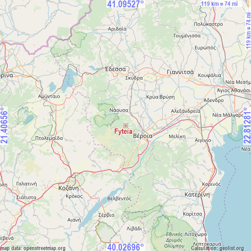
Fyteía GPS coordinates[2]
40° 33' 47.7" North, 22° 6' 34.848" East
| Map corner | latitude | longitude |
|---|---|---|
| Upper-left | 41.09527°, | 21.40656° |
| Center: | 40.56325°, | 22.10968° |
| Lower-right: | 40.02696°, | 22.81281° |
| Map W x H: | 118.8×118.8 km | = 73.8×73.8mi |
| max Lat: | 41.72048° ⇑23.6% North |
| Fyteía: | 40.56325° |
| min Lat: | ⇓76.4% South 34.8346° |
| min Long | Fyteía | max Long |
| 19.40494° | 22.10968° | 29.59361° |
| W 30.4%⇐ | ⇒69.6% E |
Elevation
Elevation of Fyteía is 472 m = 1549 ft, and this is 303.1 m = 994 ft above average elevation for this country.
| Max E: |
1439 m = 4721 ft | 11.7% |
| Fyteía | 472 m 1549 ft | |
| Avg. | 168.9 m = 554 ft | |
Min E: |
0 m = 0 ft | 88.3% |
See also: Greece elevation on elevation.city.
Geographical zone
Fyteía is located in North temperate zone (between Tropic of Cancer and the Arctic Circle). Distance of this Northern Tropic circle is 1904.3 km =1183.3 mi to South.| Distance of | km | miles | from Fyteía |
|---|---|---|---|
| North Pole | 5496.9 | 3415.6 | to North |
| Arctic Circle | 2891 | 1796.4 | to North |
| Tropic Cancer | 1904.3 | 1183.3 | to South |
| Equator | 4510.2 | 2802.5 | to South |


Nearby cities:
15 places around Fyteía: (largest is in red/bold)
• Agía Marína
9.7 km =6 mi,  67°
67°
• Charíessa
10.9 km =6.8 mi,  26°
26°
• Kopanós
8 km =5 mi,  11°
11°
• Lefkádia
10 km =6.2 mi,  4°
4°
• Makrochóri
11.9 km =7.4 mi,  96°
96°
• Monóspita
8.3 km =5.2 mi,  42°
42°
• Náousa
8.2 km =5.1 mi,  334°
334°
• Néa Lykógianni
10.9 km =6.8 mi,  84°
84°
• Néa Nikomídeia
12.1 km =7.5 mi, 77°
• Patrída
6.4 km =4 mi,  92°
92°
• Ráchi
12.5 km =7.8 mi,  134°
134°
• Stenímachos
4.7 km =2.9 mi,  16°
16°
• Trílofo
3.7 km =2.3 mi, 75°
• Véroia
8.9 km =5.5 mi,  118°
118°
• Ágios Geórgios
8.4 km =5.2 mi,  58°
58°
Sources, notices
• [Note1] Compared only with cities in Greece existing in our database
• [Src1] Map data: © OpenStreetMap contributors (CC-BY-SA)
• [Src2] Other city data from geonames.org with taken over terms of usage.
• [Src3] Geographical zone / Annual Mean Temperature by Robert A. Rohde @ Wikipedia
