Náousa geodata
Náousa (Central Macedonia) is a seat of a third-order administrative division; located in Greece in Europe/Athens (GMT+3) time zone. With population of 19,887 people, there are 93 cities with bigger population in this country. Compared to other cities in Greece, 78.7% of cities are located further ↓South; 70.5% of cities are located further →East and 83.6% of cities have lower elevation than Náousa. Note1
Administrative division(s):
- Level 1: Central Macedonia
- Level 2: Nomós Imathías
- Level 3: Dimos Naousa


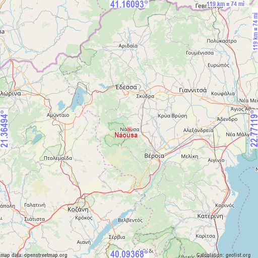
Náousa GPS coordinates[2]
40° 37' 45.984" North, 22° 4' 5.016" East
| Map corner | latitude | longitude |
|---|---|---|
| Upper-left | 41.16093°, | 21.36494° |
| Center: | 40.62944°, | 22.06806° |
| Lower-right: | 40.09368°, | 22.77119° |
| Map W x H: | 118.7×118.7 km | = 73.8×73.8mi |
| max Lat: | 41.72048° ⇑21.3% North |
| Náousa: | 40.62944° |
| min Lat: | ⇓78.7% South 34.8346° |
| min Long | Náousa | max Long |
| 19.40494° | 22.06806° | 29.59361° |
| W 29.5%⇐ | ⇒70.5% E |
Elevation
Elevation of Náousa is 350 m = 1148 ft, and this is 181.1 m = 594 ft above average elevation for this country.
| Max E: |
1439 m = 4721 ft | 16.4% |
| Náousa | 350 m 1148 ft | |
| Avg. | 168.9 m = 554 ft | |
Min E: |
0 m = 0 ft | 83.6% |
See also: Greece elevation on elevation.city.
Geographical zone
Náousa is located in North temperate zone (between Tropic of Cancer and the Arctic Circle). Distance of this Northern Tropic circle is 1911.7 km =1187.9 mi to South.| Distance of | km | miles | from Náousa |
|---|---|---|---|
| North Pole | 5489.5 | 3411 | to North |
| Arctic Circle | 2883.6 | 1791.8 | to North |
| Tropic Cancer | 1911.7 | 1187.9 | to South |
| Equator | 4517.6 | 2807.1 | to South |


Nearby cities:
15 places around Náousa: (largest is in red/bold)
• Arsénio
12.2 km =7.6 mi,  39°
39°
• Charíessa
8.7 km =5.4 mi,  73°
73°
• Eirinoúpoli
11.8 km =7.3 mi,  62°
62°
• Episkopí
8.7 km =5.4 mi, 41°
• Fyteía
8.2 km =5.1 mi,  154°
154°
• Kopanós
5.2 km =3.2 mi,  84°
84°
• Lefkádia
5 km =3.1 mi, 58°
• Marína
7.5 km =4.7 mi,  21°
21°
• Monóspita
9.2 km =5.7 mi,  97°
97°
• Petraía
12 km =7.5 mi,  32°
32°
• Polyplátanos
12 km =7.5 mi, 60°
• Rodochóri
8 km =5 mi,  327°
327°
• Stenímachos
5.7 km =3.5 mi,  120°
120°
• Trílofo
9.6 km =6 mi,  132°
132°
• Ágios Geórgios
11.1 km =6.9 mi,  105°
105°
Sources, notices
• [Note1] Compared only with cities in Greece existing in our database
• [Src1] Map data: © OpenStreetMap contributors (CC-BY-SA)
• [Src2] Other city data from geonames.org with taken over terms of usage.
• [Src3] Geographical zone / Annual Mean Temperature by Robert A. Rohde @ Wikipedia
