Trílofo geodata
Trílofo (Central Macedonia) is a populated place; located in Greece in Europe/Athens (GMT+3) time zone. With population of 818 people, there are 1252 cities with bigger population in this country. Compared to other cities in Greece, 76.7% of cities are located further ↓South; 68.7% of cities are located further →East and 70.1% of cities have lower elevation than Trílofo. Note1
Administrative division(s):
- Level 1: Central Macedonia
- Level 2: Nomós Imathías
- Level 3: Dimos Veroia


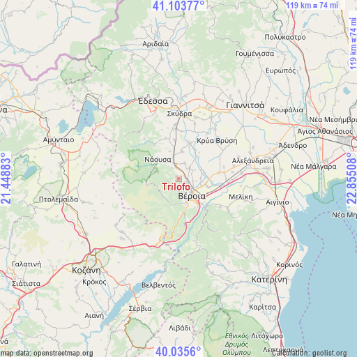
Trílofo GPS coordinates[2]
40° 34' 18.552" North, 22° 9' 7.02" East
| Map corner | latitude | longitude |
|---|---|---|
| Upper-left | 41.10377°, | 21.44883° |
| Center: | 40.57182°, | 22.15195° |
| Lower-right: | 40.0356°, | 22.85508° |
| Map W x H: | 118.8×118.8 km | = 73.8×73.8mi |
| max Lat: | 41.72048° ⇑23.3% North |
| Trílofo: | 40.57182° |
| min Lat: | ⇓76.7% South 34.8346° |
| min Long | Trílofo | max Long |
| 19.40494° | 22.15195° | 29.59361° |
| W 31.3%⇐ | ⇒68.7% E |
Elevation
Elevation of Trílofo is 167 m = 548 ft, and this is 1.9 m = 6 ft below average elevation for this country.
| Max E: |
1439 m = 4721 ft | 29.9% |
| Avg. | 168.9 m = 554 ft | |
| Trílofo | 167 m = 548 ft | |
Min E: |
0 m = 0 ft | 70.1% |
See also: Greece elevation on elevation.city.
Geographical zone
Trílofo is located in North temperate zone (between Tropic of Cancer and the Arctic Circle). Distance of this Northern Tropic circle is 1905.2 km =1183.8 mi to South.| Distance of | km | miles | from Trílofo |
|---|---|---|---|
| North Pole | 5495.9 | 3415 | to North |
| Arctic Circle | 2890 | 1795.8 | to North |
| Tropic Cancer | 1905.2 | 1183.8 | to South |
| Equator | 4511.2 | 2803.1 | to South |


Nearby cities:
15 places around Trílofo: (largest is in red/bold)
• Agía Marína
6.1 km =3.8 mi,  62°
62°
• Charíessa
8.9 km =5.5 mi,  7°
7°
• Diavatós
10.1 km =6.3 mi,  106°
106°
• Fyteía
3.7 km =2.3 mi,  255°
255°
• Kopanós
7.2 km =4.5 mi,  344°
344°
• Lefkádia
9.4 km =5.8 mi, 342°
• Makrochóri
8.6 km =5.3 mi, 105°
• Monóspita
5.6 km =3.5 mi,  21°
21°
• Náousa
9.6 km =6 mi,  312°
312°
• Néa Lykógianni
7.3 km =4.5 mi,  89°
89°
• Néa Nikomídeia
8.5 km =5.3 mi,  78°
78°
• Patrída
3.1 km =1.9 mi, 113°
• Stenímachos
4.2 km =2.6 mi,  327°
327°
• Véroia
6.8 km =4.2 mi,  141°
141°
• Ágios Geórgios
4.9 km =3 mi,  46°
46°
Sources, notices
• [Note1] Compared only with cities in Greece existing in our database
• [Src1] Map data: © OpenStreetMap contributors (CC-BY-SA)
• [Src2] Other city data from geonames.org with taken over terms of usage.
• [Src3] Geographical zone / Annual Mean Temperature by Robert A. Rohde @ Wikipedia
