Mousthéni geodata
Mousthéni (East Macedonia and Thrace) is a populated place; located in Greece in Europe/Athens (GMT+3) time zone. With population of 647 people, there are 1502 cities with bigger population in this country. Compared to other cities in Greece, 87.6% of cities are located further ↓South; 80.3% of cities are located further ←West and 76.2% of cities have lower elevation than Mousthéni. Note1
Administrative division(s):
- Level 1: East Macedonia and Thrace
- Level 2: Nomós Kaválas
- Level 3: Dimos Pangaio


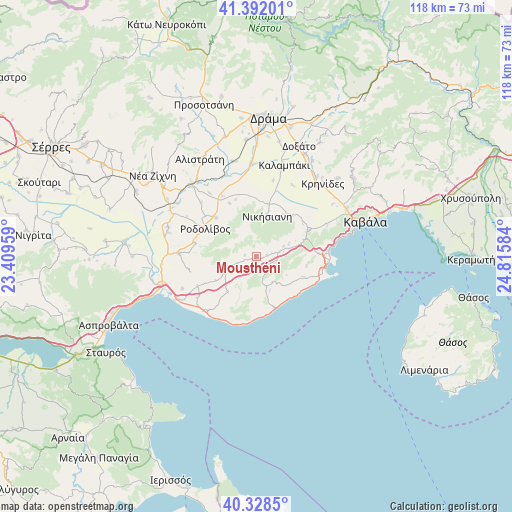
Mousthéni GPS coordinates[2]
40° 51' 44.604" North, 24° 6' 45.756" East
| Map corner | latitude | longitude |
|---|---|---|
| Upper-left | 41.39201°, | 23.40959° |
| Center: | 40.86239°, | 24.11271° |
| Lower-right: | 40.3285°, | 24.81584° |
| Map W x H: | 118.3×118.3 km | = 73.5×73.5mi |
| max Lat: | 41.72048° ⇑12.4% North |
| Mousthéni: | 40.86239° |
| min Lat: | ⇓87.6% South 34.8346° |
| min Long | Mousthéni | max Long |
| 19.40494° | 24.11271° | 29.59361° |
| W 80.3%⇐ | ⇒19.7% E |
Elevation
Elevation of Mousthéni is 223 m = 732 ft, and this is 54.1 m = 177 ft above average elevation for this country.
| Max E: |
1439 m = 4721 ft | 23.8% |
| Mousthéni | 223 m 732 ft | |
| Avg. | 168.9 m = 554 ft | |
Min E: |
0 m = 0 ft | 76.2% |
See also: Greece elevation on elevation.city.
Geographical zone
Mousthéni is located in North temperate zone (between Tropic of Cancer and the Arctic Circle). Distance of this Northern Tropic circle is 1937.6 km =1204 mi to South.| Distance of | km | miles | from Mousthéni |
|---|---|---|---|
| North Pole | 5463.6 | 3394.9 | to North |
| Arctic Circle | 2857.7 | 1775.7 | to North |
| Tropic Cancer | 1937.6 | 1204 | to South |
| Equator | 4543.5 | 2823.2 | to South |


Nearby cities:
15 places around Mousthéni: (largest is in red/bold)
• Akropótamos
10.4 km =6.5 mi,  218°
218°
• Antifílippoi
12.4 km =7.7 mi,  41°
41°
• Avlí
5.7 km =3.5 mi,  78°
78°
• Elaiochóri
12 km =7.5 mi,  113°
113°
• Eleftheroúpolis
13 km =8.1 mi,  63°
63°
• Eleftherés
12 km =7.5 mi,  98°
98°
• Foliá
7 km =4.3 mi,  147°
147°
• Georgianí
10.9 km =6.8 mi,  15°
15°
• Nikísiani
9.8 km =6.1 mi, 15°
• Palaiochóri
10.5 km =6.5 mi,  31°
31°
• Panagiá
11.5 km =7.1 mi,  70°
70°
• Platanótopos
4.7 km =2.9 mi,  249°
249°
• Podhokhóri
8.2 km =5.1 mi,  244°
244°
• Próti
13.1 km =8.1 mi,  314°
314°
• Rodolívos
13.3 km =8.3 mi,  299°
299°
Sources, notices
• [Note1] Compared only with cities in Greece existing in our database
• [Src1] Map data: © OpenStreetMap contributors (CC-BY-SA)
• [Src2] Other city data from geonames.org with taken over terms of usage.
• [Src3] Geographical zone / Annual Mean Temperature by Robert A. Rohde @ Wikipedia
