Sololá geodata
Sololá is a seat of a first-order administrative division; located in Guatemala in America/Guatemala (GMT-6) time zone. With population of 45,373 people, there are 23 cities with bigger population in this country. Compared to other cities in Guatemala, 52.8% of cities are located further ↑North; 58.7% of cities are located further →East and 81.4% of cities have lower elevation than Sololá. Note1


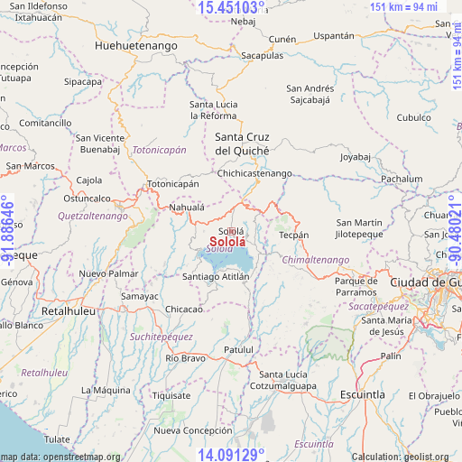
Sololá GPS coordinates[2]
14° 46' 19.992" North, 91° 10' 59.988" West
| Map corner | latitude | longitude |
|---|---|---|
| Upper-left | 15.45103°, | -91.88646° |
| Center: | 14.77222°, | -91.18333° |
| Lower-right: | 14.09129°, | -90.48021° |
| Map W x H: | 151.2×151.2 km | = 94×94mi |
| max Lat: | 17.06606° ⇑52.8% North |
| Sololá: | 14.77222° |
| min Lat: | ⇓47.2% South 13.9274° |
| min Long | Sololá | max Long |
| -92.19298° | -91.18333° | -88.59444° |
| W 41.3%⇐ | ⇒58.7% E |
Elevation
Elevation of Sololá is 2126 m = 6975 ft, and this is 859 m = 2818 ft above average elevation for this country.
| Max E: |
3254 m = 10676 ft | 18.6% |
| Sololá | 2126 m 6975 ft | |
| Avg. | 1267 m = 4157 ft | |
Min E: |
1 m = 3 ft | 81.4% |
See also: Sololá elevation on elevation.city.
Geographical zone
Sololá is located in North Torrid zone (between Equator and Tropic of Cancer). Distance of this Northern Tropic circle is 963.4 km =598.6 mi to North.| Distance of | km | miles | from Sololá |
|---|---|---|---|
| North Pole | 8364.5 | 5197.5 | to North |
| Arctic Circle | 5758.7 | 3578.3 | to North |
| Tropic Cancer | 963.4 | 598.6 | to North |
| Equator | 1642.5 | 1020.6 | to South |


Nearby cities:
15 places around Sololá: (largest is in red/bold)
• Concepción
4.1 km =2.5 mi,  70°
70°
• Panajachel
4.4 km =2.7 mi,  139°
139°
• San Andrés Semetabaj
6.2 km =3.9 mi,  119°
119°
• San Antonio Palopó
11.4 km =7.1 mi, 140°
• San José Chacayá
3.5 km =2.2 mi,  267°
267°
• San Juan La Laguna
14.1 km =8.8 mi,  232°
232°
• San Marcos La Laguna
9.6 km =6 mi,  236°
236°
• San Pablo La Laguna
11.1 km =6.9 mi, 239°
• San Pedro La Laguna
13 km =8.1 mi, 227°
• Santa Catarina Palopó
7.6 km =4.7 mi, 135°
• Santa Clara La Laguna
14.4 km =8.9 mi, 243°
• Santa Cruz La Laguna
4 km =2.5 mi,  219°
219°
• Santa Lucía Utatlán
9 km =5.6 mi, 269°
• Santa María Visitación
14.8 km =9.2 mi,  245°
245°
• Santiago Atitlán
15.7 km =9.8 mi,  198°
198°
Sources, notices
• [Note1] Compared only with cities in Guatemala existing in our database
• [Src1] Map data: © OpenStreetMap contributors (CC-BY-SA)
• [Src2] Other city data from geonames.org with taken over terms of usage.
• [Src3] Geographical zone / Annual Mean Temperature by Robert A. Rohde @ Wikipedia
