Santiago Atitlán geodata
Santiago Atitlán (Sololá) is a populated place; located in Guatemala in America/Guatemala (GMT-6) time zone. With population of 33,309 people, there are 33 cities with bigger population in this country. Compared to other cities in Guatemala, 66.1% of cities are located further ↑North; 60.2% of cities are located further →East and 63.4% of cities have lower elevation than Santiago Atitlán. Note1


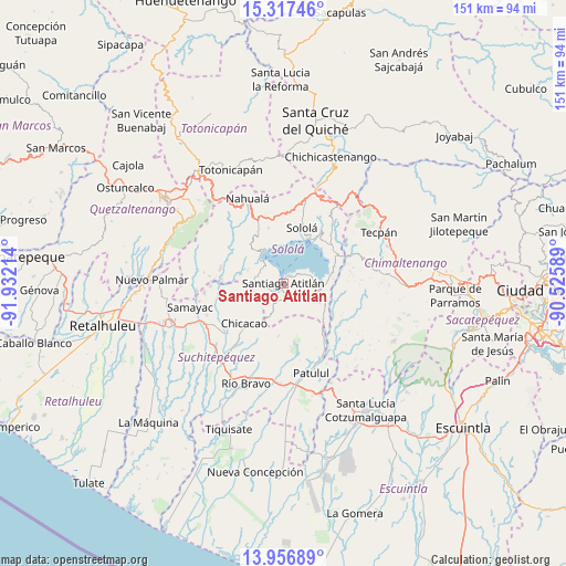
Santiago Atitlán GPS coordinates[2]
14° 38' 17.628" North, 91° 13' 44.436" West
| Map corner | latitude | longitude |
|---|---|---|
| Upper-left | 15.31746°, | -91.93214° |
| Center: | 14.63823°, | -91.22901° |
| Lower-right: | 13.95689°, | -90.52589° |
| Map W x H: | 151.3×151.3 km | = 94×94mi |
| max Lat: | 17.06606° ⇑66.1% North |
| Santiago Atitlán: | 14.63823° |
| min Lat: | ⇓33.9% South 13.9274° |
| min Long | Santiago Atitl� | max Long |
| -92.19298° | -91.22901° | -88.59444° |
| W 39.8%⇐ | ⇒60.2% E |
Elevation
Elevation of Santiago Atitlán is 1603 m = 5259 ft, and this is 336 m = 1102 ft above average elevation for this country.
| Max E: |
3254 m = 10676 ft | 36.6% |
| Santiago Atitlán | 1603 m 5259 ft | |
| Avg. | 1267 m = 4157 ft | |
Min E: |
1 m = 3 ft | 63.4% |
See also: Guatemala elevation on elevation.city.
Geographical zone
Santiago Atitlán is located in North Torrid zone (between Equator and Tropic of Cancer). Distance of this Northern Tropic circle is 978.3 km =607.9 mi to North.| Distance of | km | miles | from Santiago Atitlán |
|---|---|---|---|
| North Pole | 8379.4 | 5206.7 | to North |
| Arctic Circle | 5773.6 | 3587.5 | to North |
| Tropic Cancer | 978.3 | 607.9 | to North |
| Equator | 1627.6 | 1011.3 | to South |


Nearby cities:
15 places around Santiago Atitlán: (largest is in red/bold)
• Chicacao
14.9 km =9.3 mi,  224°
224°
• Panajachel
13.9 km =8.6 mi,  33°
33°
• San Antonio Palopó
13.5 km =8.4 mi,  63°
63°
• San José Chacayá
14.8 km =9.2 mi,  5°
5°
• San Juan La Laguna
8.8 km =5.5 mi,  315°
315°
• San Lucas Tolimán
10.1 km =6.3 mi,  118°
118°
• San Marcos La Laguna
10.2 km =6.3 mi,  341°
341°
• San Pablo La Laguna
10.3 km =6.4 mi,  333°
333°
• San Pedro La Laguna
7.6 km =4.7 mi, 322°
• Santa Catarina Palopó
13.9 km =8.6 mi,  47°
47°
• Santa Clara La Laguna
11.7 km =7.3 mi, 316°
• Santa Cruz La Laguna
12 km =7.5 mi, 11°
• Santa Lucía Utatlán
15.4 km =9.6 mi, 344°
• Santa María Visitación
12.2 km =7.6 mi, 315°
• Sololá
15.7 km =9.8 mi,  18°
18°
Sources, notices
• [Note1] Compared only with cities in Guatemala existing in our database
• [Src1] Map data: © OpenStreetMap contributors (CC-BY-SA)
• [Src2] Other city data from geonames.org with taken over terms of usage.
• [Src3] Geographical zone / Annual Mean Temperature by Robert A. Rohde @ Wikipedia
