San Pedro La Laguna geodata
San Pedro La Laguna (Sololá) is a populated place; located in Guatemala in America/Guatemala (GMT-6) time zone. With population of 9,681 people, there are 132 cities with bigger population in this country. Compared to other cities in Guatemala, 60.5% of cities are located further ↑North; 61.7% of cities are located further →East and 62.5% of cities have lower elevation than San Pedro La Laguna. Note1


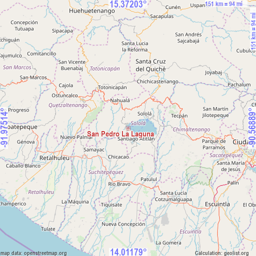
San Pedro La Laguna GPS coordinates[2]
14° 41' 34.692" North, 91° 16' 19.236" West
| Map corner | latitude | longitude |
|---|---|---|
| Upper-left | 15.37203°, | -91.97514° |
| Center: | 14.69297°, | -91.27201° |
| Lower-right: | 14.01179°, | -90.56889° |
| Map W x H: | 151.2×151.2 km | = 94×94mi |
| max Lat: | 17.06606° ⇑60.5% North |
| San Pedro La Laguna: | 14.69297° |
| min Lat: | ⇓39.5% South 13.9274° |
| min Long | San Pedro La La | max Long |
| -92.19298° | -91.27201° | -88.59444° |
| W 38.3%⇐ | ⇒61.7% E |
Elevation
Elevation of San Pedro La Laguna is 1590 m = 5217 ft, and this is 323 m = 1060 ft above average elevation for this country.
| Max E: |
3254 m = 10676 ft | 37.5% |
| San Pedro La Laguna | 1590 m 5217 ft | |
| Avg. | 1267 m = 4157 ft | |
Min E: |
1 m = 3 ft | 62.5% |
See also: Guatemala elevation on elevation.city.
Geographical zone
San Pedro La Laguna is located in North Torrid zone (between Equator and Tropic of Cancer). Distance of this Northern Tropic circle is 972.2 km =604.1 mi to North.| Distance of | km | miles | from San Pedro La Laguna |
|---|---|---|---|
| North Pole | 8373.4 | 5203 | to North |
| Arctic Circle | 5767.5 | 3583.8 | to North |
| Tropic Cancer | 972.2 | 604.1 | to North |
| Equator | 1633.7 | 1015.1 | to South |


Nearby cities:
15 places around San Pedro La Laguna: (largest is in red/bold)
• Panajachel
13.5 km =8.4 mi,  66°
66°
• San Andrés Semetabaj
16 km =9.9 mi, 68°
• San José Chacayá
10.6 km =6.6 mi,  34°
34°
• San Juan La Laguna
1.6 km =1 mi,  276°
276°
• San Marcos La Laguna
3.9 km =2.4 mi,  22°
22°
• San Pablo La Laguna
3.1 km =1.9 mi,  359°
359°
• Santa Catarina Ixtahuacán
14.9 km =9.3 mi,  321°
321°
• Santa Catarina Palopó
15.2 km =9.4 mi,  77°
77°
• Santa Clara La Laguna
4.2 km =2.6 mi,  305°
305°
• Santa Cruz La Laguna
9 km =5.6 mi,  50°
50°
• Santa Lucía Utatlán
8.7 km =5.4 mi,  3°
3°
• Santa María Visitación
4.8 km =3 mi,  304°
304°
• Santiago Atitlán
7.6 km =4.7 mi,  142°
142°
• Santo Tomás La Unión
16.4 km =10.2 mi,  245°
245°
• Sololá
13 km =8.1 mi, 47°
Sources, notices
• [Note1] Compared only with cities in Guatemala existing in our database
• [Src1] Map data: © OpenStreetMap contributors (CC-BY-SA)
• [Src2] Other city data from geonames.org with taken over terms of usage.
• [Src3] Geographical zone / Annual Mean Temperature by Robert A. Rohde @ Wikipedia
