San Antonio Palopó geodata
San Antonio Palopó (Sololá) is a seat of a second-order administrative division; located in Guatemala in America/Guatemala (GMT-6) time zone. With population of 3,588 people, there are 232 cities with bigger population in this country. Compared to other cities in Guatemala, 60.8% of cities are located further ↑North; 55.5% of cities are located further →East and 69% of cities have lower elevation than San Antonio Palopó. Note1


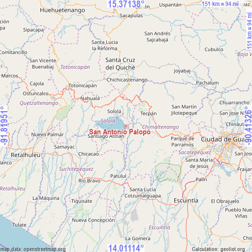
San Antonio Palopó GPS coordinates[2]
14° 41' 32.352" North, 91° 6' 58.968" West
| Map corner | latitude | longitude |
|---|---|---|
| Upper-left | 15.37138°, | -91.81951° |
| Center: | 14.69232°, | -91.11638° |
| Lower-right: | 14.01114°, | -90.41326° |
| Map W x H: | 151.2×151.2 km | = 94×94mi |
| max Lat: | 17.06606° ⇑60.8% North |
| San Antonio Palopó: | 14.69232° |
| min Lat: | ⇓39.2% South 13.9274° |
| min Long | San Antonio Pal | max Long |
| -92.19298° | -91.11638° | -88.59444° |
| W 44.5%⇐ | ⇒55.5% E |
Elevation
Elevation of San Antonio Palopó is 1773 m = 5817 ft, and this is 506 m = 1660 ft above average elevation for this country.
| Max E: |
3254 m = 10676 ft | 31% |
| San Antonio Palopó | 1773 m 5817 ft | |
| Avg. | 1267 m = 4157 ft | |
Min E: |
1 m = 3 ft | 69% |
See also: Guatemala elevation on elevation.city.
Geographical zone
San Antonio Palopó is located in North Torrid zone (between Equator and Tropic of Cancer). Distance of this Northern Tropic circle is 972.3 km =604.2 mi to North.| Distance of | km | miles | from San Antonio Palopó |
|---|---|---|---|
| North Pole | 8373.4 | 5203 | to North |
| Arctic Circle | 5767.5 | 3583.8 | to North |
| Tropic Cancer | 972.3 | 604.2 | to North |
| Equator | 1633.6 | 1015.1 | to South |


Nearby cities:
15 places around San Antonio Palopó: (largest is in red/bold)
• Concepción
10.7 km =6.6 mi,  341°
341°
• Panajachel
7 km =4.3 mi,  321°
321°
• Patzún
11.1 km =6.9 mi,  96°
96°
• Pochuta
16.7 km =10.4 mi,  169°
169°
• San Andrés Semetabaj
6.1 km =3.8 mi, 342°
• San José Chacayá
13.8 km =8.6 mi,  309°
309°
• San Lucas Tolimán
11.3 km =7 mi,  196°
196°
• San Marcos La Laguna
15.7 km =9.8 mi,  283°
283°
• San Pablo La Laguna
17.1 km =10.6 mi, 280°
• San Pedro La Laguna
16.7 km =10.4 mi,  270°
270°
• Santa Catarina Palopó
4 km =2.5 mi,  330°
330°
• Santa Cruz La Laguna
11.3 km =7 mi,  300°
300°
• Santiago Atitlán
13.5 km =8.4 mi,  243°
243°
• Sololá
11.4 km =7.1 mi, 320°
• Tecpán Guatemala
15.4 km =9.6 mi,  59°
59°
Sources, notices
• [Note1] Compared only with cities in Guatemala existing in our database
• [Src1] Map data: © OpenStreetMap contributors (CC-BY-SA)
• [Src2] Other city data from geonames.org with taken over terms of usage.
• [Src3] Geographical zone / Annual Mean Temperature by Robert A. Rohde @ Wikipedia
