Quesada geodata
Quesada (Jutiapa) is a seat of a second-order administrative division; located in Guatemala in America/Guatemala (GMT-6) time zone. With population of 2,250 people, there are 269 cities with bigger population in this country. Compared to other cities in Guatemala, 92.6% of cities are located further ↑North; 80.2% of cities are located further ←West and 59% of cities have higher elevation than Quesada. Note1


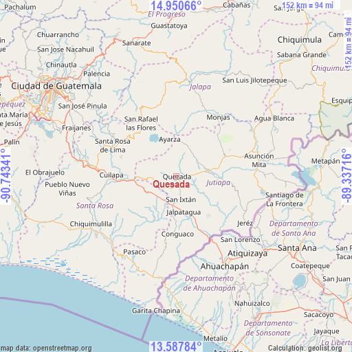
Quesada GPS coordinates[2]
14° 16' 13.008" North, 90° 2' 25.008" West
| Map corner | latitude | longitude |
|---|---|---|
| Upper-left | 14.95066°, | -90.74341° |
| Center: | 14.27028°, | -90.04028° |
| Lower-right: | 13.58784°, | -89.33716° |
| Map W x H: | 151.5×151.5 km | = 94.1×94.1mi |
| max Lat: | 17.06606° ⇑92.6% North |
| Quesada: | 14.27028° |
| min Lat: | ⇓7.4% South 13.9274° |
| min Long | Quesada | max Long |
| -92.19298° | -90.04028° | -88.59444° |
| W 80.2%⇐ | ⇒19.8% E |
Elevation
Elevation of Quesada is 974 m = 3196 ft, and this is 293 m = 961 ft below average elevation for this country.
| Max E: |
3254 m = 10676 ft | 59% |
| Avg. | 1267 m = 4157 ft | |
| Quesada | 974 m = 3196 ft | |
Min E: |
1 m = 3 ft | 41% |
See also: Guatemala elevation on elevation.city.
Geographical zone
Quesada is located in North Torrid zone (between Equator and Tropic of Cancer). Distance of this Northern Tropic circle is 1019.2 km =633.3 mi to North.| Distance of | km | miles | from Quesada |
|---|---|---|---|
| North Pole | 8420.4 | 5232.2 | to North |
| Arctic Circle | 5814.5 | 3613 | to North |
| Tropic Cancer | 1019.2 | 633.3 | to North |
| Equator | 1586.7 | 985.9 | to South |


Nearby cities:
15 places around Quesada: (largest is in red/bold)
• Casillas
27.4 km =17 mi,  307°
307°
• Comapa
21.7 km =13.5 mi,  142°
142°
• Conguaco
25.2 km =15.7 mi,  177°
177°
• Cuilapa
27.9 km =17.3 mi,  271°
271°
• El Adelanto
25.1 km =15.6 mi,  117°
117°
• El Progreso
22.3 km =13.9 mi,  66°
66°
• Jalpatagua
14.7 km =9.1 mi,  166°
166°
• Jutiapa
15.7 km =9.8 mi,  81°
81°
• Moyuta
26.1 km =16.2 mi,  189°
189°
• Oratorio
15.3 km =9.5 mi,  252°
252°
• San Carlos Alzatate
25.4 km =15.8 mi,  355°
355°
• San José Acatempa
9.4 km =5.8 mi, 266°
• San Rafael Las Flores
27.3 km =17 mi,  326°
326°
• Santa María Ixhuatán
26.8 km =16.7 mi, 250°
• Zapotitlán
27 km =16.8 mi, 124°
Sources, notices
• [Note1] Compared only with cities in Guatemala existing in our database
• [Src1] Map data: © OpenStreetMap contributors (CC-BY-SA)
• [Src2] Other city data from geonames.org with taken over terms of usage.
• [Src3] Geographical zone / Annual Mean Temperature by Robert A. Rohde @ Wikipedia
