Santa Rita geodata
Santa Rita (Santa Bárbara) is a populated place; located in Honduras in America/Tegucigalpa (GMT-6) time zone. With population of 1,687 people, there are 219 cities with bigger population in this country. Compared to other cities in Honduras, 52% of cities are located further ↓South; 75.6% of cities are located further →East and 64% of cities have higher elevation than Santa Rita. Note1


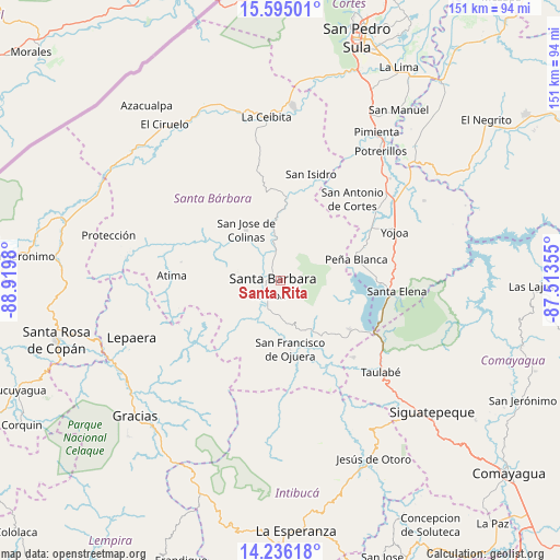
Santa Rita GPS coordinates[2]
14° 55' 0.012" North, 88° 13' 0.012" West
| Map corner | latitude | longitude |
|---|---|---|
| Upper-left | 15.59501°, | -88.9198° |
| Center: | 14.91667°, | -88.21667° |
| Lower-right: | 14.23618°, | -87.51355° |
| Map W x H: | 151.1×151.1 km | = 93.9×93.9mi |
| max Lat: | 16.45° ⇑48% North |
| Santa Rita: | 14.91667° |
| min Lat: | ⇓52% South 13.11667° |
| min Long | Santa Rita | max Long |
| -89.23333° | -88.21667° | -83.23333° |
| W 24.4%⇐ | ⇒75.6% E |
Elevation
Elevation of Santa Rita is 334 m = 1096 ft, and this is 227.2 m = 745 ft below average elevation for this country.
| Max E: |
1811 m = 5942 ft | 64% |
| Avg. | 561.2 m = 1841 ft | |
| Santa Rita | 334 m = 1096 ft | |
Min E: |
1 m = 3 ft | 36% |
See also: Honduras elevation on elevation.city.
Geographical zone
Santa Rita is located in North Torrid zone (between Equator and Tropic of Cancer). Distance of this Northern Tropic circle is 947.3 km =588.6 mi to North.| Distance of | km | miles | from Santa Rita |
|---|---|---|---|
| North Pole | 8348.5 | 5187.5 | to North |
| Arctic Circle | 5742.6 | 3568.3 | to North |
| Tropic Cancer | 947.3 | 588.6 | to North |
| Equator | 1658.6 | 1030.6 | to South |


Nearby cities:
15 places around Santa Rita: (largest is in red/bold)
• Arada
11.6 km =7.2 mi,  230°
230°
• Ceguaca
13.1 km =8.1 mi,  172°
172°
• Concepción del Sur
14 km =8.7 mi,  157°
157°
• El Mochito
15.4 km =9.6 mi,  111°
111°
• Guacamaya
13.2 km =8.2 mi,  32°
32°
• Gualjoco
4.1 km =2.5 mi,  334°
334°
• Las Vegas, Santa Barbara
15.9 km =9.9 mi, 106°
• Macholoa
9 km =5.6 mi,  270°
270°
• Nueva Jalapa
12.5 km =7.8 mi, 270°
• Nuevo Celilac
14.6 km =9.1 mi,  300°
300°
• San José de Colinas
15.8 km =9.8 mi, 325°
• San Luis de Planes
11.6 km =7.2 mi,  50°
50°
• San Nicolás
10.9 km =6.8 mi,  279°
279°
• San Vicente Centenario
8.1 km =5 mi,  242°
242°
• Santa Bárbara
2.1 km =1.3 mi, 278°
Sources, notices
• [Note1] Compared only with cities in Honduras existing in our database
• [Src1] Map data: © OpenStreetMap contributors (CC-BY-SA)
• [Src2] Other city data from geonames.org with taken over terms of usage.
• [Src3] Geographical zone / Annual Mean Temperature by Robert A. Rohde @ Wikipedia
