San Luis de Planes geodata
San Luis de Planes (Santa Bárbara) is a populated place; located in Honduras in America/Tegucigalpa (GMT-6) time zone. With population of 1,111 people, there are 352 cities with bigger population in this country. Compared to other cities in Honduras, 56.4% of cities are located further ↓South; 72.8% of cities are located further →East and 97.8% of cities have lower elevation than San Luis de Planes. Note1


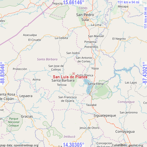
San Luis de Planes GPS coordinates[2]
14° 58' 59.988" North, 88° 7' 59.988" West
| Map corner | latitude | longitude |
|---|---|---|
| Upper-left | 15.66146°, | -88.83646° |
| Center: | 14.98333°, | -88.13333° |
| Lower-right: | 14.30305°, | -87.43021° |
| Map W x H: | 151×151 km | = 93.8×93.8mi |
| max Lat: | 16.45° ⇑43.6% North |
| San Luis de Planes: | 14.98333° |
| min Lat: | ⇓56.4% South 13.11667° |
| min Long | San Luis de Pla | max Long |
| -89.23333° | -88.13333° | -83.23333° |
| W 27.2%⇐ | ⇒72.8% E |
Elevation
Elevation of San Luis de Planes is 1495 m = 4905 ft, and this is 933.8 m = 3064 ft above average elevation for this country.
| Max E: |
1811 m = 5942 ft | 2.2% |
| San Luis de Planes | 1495 m 4905 ft | |
| Avg. | 561.2 m = 1841 ft | |
Min E: |
1 m = 3 ft | 97.8% |
See also: Honduras elevation on elevation.city.
Geographical zone
San Luis de Planes is located in North Torrid zone (between Equator and Tropic of Cancer). Distance of this Northern Tropic circle is 939.9 km =584 mi to North.| Distance of | km | miles | from San Luis de Planes |
|---|---|---|---|
| North Pole | 8341.1 | 5182.9 | to North |
| Arctic Circle | 5735.2 | 3563.7 | to North |
| Tropic Cancer | 939.9 | 584 | to North |
| Equator | 1666 | 1035.2 | to South |


Nearby cities:
15 places around San Luis de Planes: (largest is in red/bold)
• Casa Quemada
15.8 km =9.8 mi,  19°
19°
• Cañaveral
12.5 km =7.8 mi,  90°
90°
• El Edén
13.1 km =8.1 mi,  106°
106°
• El Mochito
14 km =8.7 mi,  157°
157°
• El Perico
11.7 km =7.3 mi, 17°
• Guacamaya
4.1 km =2.5 mi,  334°
334°
• Gualjoco
11.4 km =7.1 mi,  250°
250°
• Ilama
12.9 km =8 mi,  315°
315°
• Las Vegas, Santa Barbara
13.4 km =8.3 mi,  152°
152°
• Los Naranjos
12.9 km =8 mi,  135°
135°
• Nueva Granada
15.3 km =9.5 mi,  13°
13°
• San Buenaventura
14.8 km =9.2 mi,  75°
75°
• San José de Oriente
5.8 km =3.6 mi, 17°
• Santa Bárbara
13.1 km =8.1 mi,  237°
237°
• Santa Rita
11.6 km =7.2 mi,  230°
230°
Sources, notices
• [Note1] Compared only with cities in Honduras existing in our database
• [Src1] Map data: © OpenStreetMap contributors (CC-BY-SA)
• [Src2] Other city data from geonames.org with taken over terms of usage.
• [Src3] Geographical zone / Annual Mean Temperature by Robert A. Rohde @ Wikipedia
