San Juan de Planes geodata
San Juan de Planes (Copán) is a populated place; located in Honduras in America/Tegucigalpa (GMT-6) time zone. With population of 1,048 people, there are 391 cities with bigger population in this country. Compared to other cities in Honduras, 53.8% of cities are located further ↓South; 90.8% of cities are located further →East and 72.2% of cities have lower elevation than San Juan de Planes. Note1


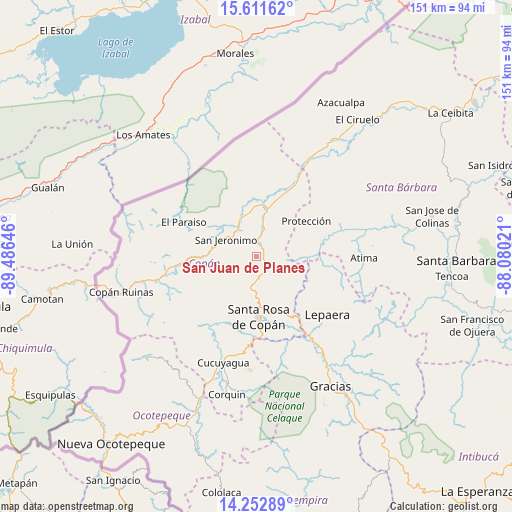
San Juan de Planes GPS coordinates[2]
14° 55' 59.988" North, 88° 46' 59.988" West
| Map corner | latitude | longitude |
|---|---|---|
| Upper-left | 15.61162°, | -89.48646° |
| Center: | 14.93333°, | -88.78333° |
| Lower-right: | 14.25289°, | -88.08021° |
| Map W x H: | 151.1×151.1 km | = 93.9×93.9mi |
| max Lat: | 16.45° ⇑46.2% North |
| San Juan de Planes: | 14.93333° |
| min Lat: | ⇓53.8% South 13.11667° |
| min Long | San Juan de Pla | max Long |
| -89.23333° | -88.78333° | -83.23333° |
| W 9.2%⇐ | ⇒90.8% E |
Elevation
Elevation of San Juan de Planes is 793 m = 2602 ft, and this is 231.8 m = 760 ft above average elevation for this country.
| Max E: |
1811 m = 5942 ft | 27.8% |
| San Juan de Planes | 793 m 2602 ft | |
| Avg. | 561.2 m = 1841 ft | |
Min E: |
1 m = 3 ft | 72.2% |
See also: Honduras elevation on elevation.city.
Geographical zone
San Juan de Planes is located in North Torrid zone (between Equator and Tropic of Cancer). Distance of this Northern Tropic circle is 945.5 km =587.5 mi to North.| Distance of | km | miles | from San Juan de Planes |
|---|---|---|---|
| North Pole | 8346.6 | 5186.3 | to North |
| Arctic Circle | 5740.7 | 3567.1 | to North |
| Tropic Cancer | 945.5 | 587.5 | to North |
| Equator | 1660.4 | 1031.7 | to South |


Nearby cities:
15 places around San Juan de Planes: (largest is in red/bold)
• Agua Caliente
6.6 km =4.1 mi,  212°
212°
• Dolores
9.2 km =5.7 mi,  215°
215°
• Dulce Nombre
10.7 km =6.6 mi, 210°
• Florida
12.3 km =7.6 mi,  334°
334°
• La Entrada
14 km =8.7 mi,  22°
22°
• La Jigua
11.3 km =7 mi,  350°
350°
• Naranjito
10.9 km =6.8 mi,  80°
80°
• Pueblo Nuevo
8.2 km =5.1 mi,  25°
25°
• Quezailica
7.7 km =4.8 mi,  135°
135°
• San Jerónimo
9.7 km =6 mi,  292°
292°
• San José de Copán
8.1 km =5 mi,  117°
117°
• San Nicolás
8.2 km =5.1 mi, 25°
• Trinidad de Copán
4 km =2.5 mi,  62°
62°
• Veracruz
1.9 km =1.2 mi,  180°
180°
• Vivistorio
6.5 km =4 mi, 124°
Sources, notices
• [Note1] Compared only with cities in Honduras existing in our database
• [Src1] Map data: © OpenStreetMap contributors (CC-BY-SA)
• [Src2] Other city data from geonames.org with taken over terms of usage.
• [Src3] Geographical zone / Annual Mean Temperature by Robert A. Rohde @ Wikipedia
