Agua Caliente geodata
Agua Caliente (Copán) is a populated place; located in Honduras in America/Tegucigalpa (GMT-6) time zone. With population of 1,075 people, there are 374 cities with bigger population in this country. Compared to other cities in Honduras, 50.2% of cities are located further ↑North; 91.8% of cities are located further →East and 79.8% of cities have lower elevation than Agua Caliente. Note1


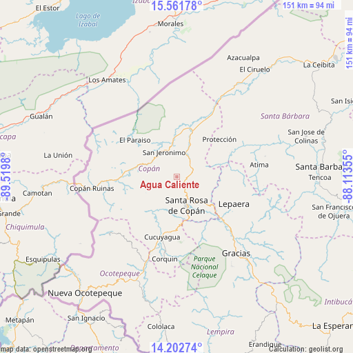
Agua Caliente GPS coordinates[2]
14° 52' 59.988" North, 88° 49' 0.012" West
| Map corner | latitude | longitude |
|---|---|---|
| Upper-left | 15.56178°, | -89.5198° |
| Center: | 14.88333°, | -88.81667° |
| Lower-right: | 14.20274°, | -88.11355° |
| Map W x H: | 151.1×151.1 km | = 93.9×93.9mi |
| max Lat: | 16.45° ⇑50.2% North |
| Agua Caliente: | 14.88333° |
| min Lat: | ⇓49.8% South 13.11667° |
| min Long | Agua Caliente | max Long |
| -89.23333° | -88.81667° | -83.23333° |
| W 8.2%⇐ | ⇒91.8% E |
Elevation
Elevation of Agua Caliente is 932 m = 3058 ft, and this is 370.8 m = 1217 ft above average elevation for this country.
| Max E: |
1811 m = 5942 ft | 20.2% |
| Agua Caliente | 932 m 3058 ft | |
| Avg. | 561.2 m = 1841 ft | |
Min E: |
1 m = 3 ft | 79.8% |
See also: Honduras elevation on elevation.city.
Geographical zone
Agua Caliente is located in North Torrid zone (between Equator and Tropic of Cancer). Distance of this Northern Tropic circle is 951 km =590.9 mi to North.| Distance of | km | miles | from Agua Caliente |
|---|---|---|---|
| North Pole | 8352.2 | 5189.8 | to North |
| Arctic Circle | 5746.3 | 3570.6 | to North |
| Tropic Cancer | 951 | 590.9 | to North |
| Equator | 1654.9 | 1028.3 | to South |


Nearby cities:
15 places around Agua Caliente: (largest is in red/bold)
• Dolores
2.6 km =1.6 mi,  224°
224°
• Dulce Nombre
4.1 km =2.5 mi,  205°
205°
• El Derrumbo
15.3 km =9.5 mi,  166°
166°
• Naranjito
16.1 km =10 mi,  62°
62°
• Pueblo Nuevo
14.8 km =9.2 mi,  28°
28°
• Quezailica
9 km =5.6 mi,  90°
90°
• San Agustín
14.6 km =9.1 mi,  239°
239°
• San Jerónimo
10.7 km =6.6 mi,  329°
329°
• San José de Copán
10.9 km =6.8 mi,  80°
80°
• San Juan de Planes
6.6 km =4.1 mi, 32°
• San Nicolás
14.8 km =9.2 mi, 28°
• Santa Rosa de Copán
13.6 km =8.5 mi,  162°
162°
• Trinidad de Copán
10.3 km =6.4 mi,  44°
44°
• Veracruz
5.2 km =3.2 mi, 44°
• Vivistorio
9.1 km =5.7 mi, 78°
Sources, notices
• [Note1] Compared only with cities in Honduras existing in our database
• [Src1] Map data: © OpenStreetMap contributors (CC-BY-SA)
• [Src2] Other city data from geonames.org with taken over terms of usage.
• [Src3] Geographical zone / Annual Mean Temperature by Robert A. Rohde @ Wikipedia
