San Fernando geodata
San Fernando (Ocotepeque) is a populated place; located in Honduras in America/Tegucigalpa (GMT-6) time zone. With population of 1,026 people, there are 406 cities with bigger population in this country. Compared to other cities in Honduras, 62.4% of cities are located further ↑North; 98.2% of cities are located further →East and 91.4% of cities have lower elevation than San Fernando. Note1


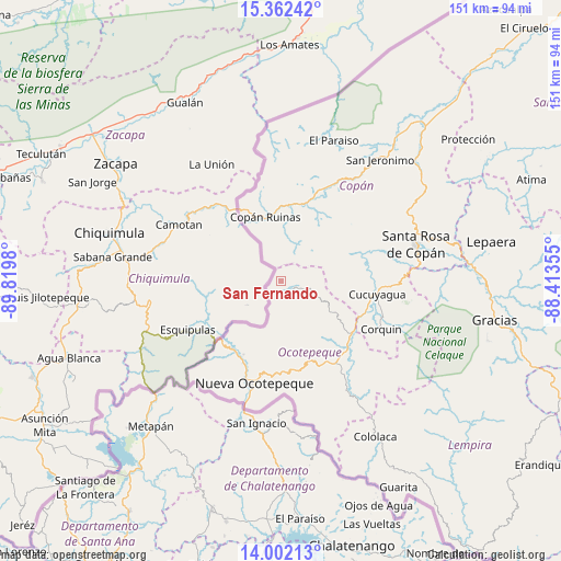
San Fernando GPS coordinates[2]
14° 40' 59.988" North, 89° 7' 0.012" West
| Map corner | latitude | longitude |
|---|---|---|
| Upper-left | 15.36242°, | -89.8198° |
| Center: | 14.68333°, | -89.11667° |
| Lower-right: | 14.00213°, | -88.41355° |
| Map W x H: | 151.3×151.3 km | = 94×94mi |
| max Lat: | 16.45° ⇑62.4% North |
| San Fernando: | 14.68333° |
| min Lat: | ⇓37.6% South 13.11667° |
| min Long | San Fernando | max Long |
| -89.23333° | -89.11667° | -83.23333° |
| W 1.8%⇐ | ⇒98.2% E |
Elevation
Elevation of San Fernando is 1207 m = 3960 ft, and this is 645.8 m = 2119 ft above average elevation for this country.
| Max E: |
1811 m = 5942 ft | 8.6% |
| San Fernando | 1207 m 3960 ft | |
| Avg. | 561.2 m = 1841 ft | |
Min E: |
1 m = 3 ft | 91.4% |
See also: Honduras elevation on elevation.city.
Geographical zone
San Fernando is located in North Torrid zone (between Equator and Tropic of Cancer). Distance of this Northern Tropic circle is 973.3 km =604.8 mi to North.| Distance of | km | miles | from San Fernando |
|---|---|---|---|
| North Pole | 8374.4 | 5203.6 | to North |
| Arctic Circle | 5768.5 | 3584.4 | to North |
| Tropic Cancer | 973.3 | 604.8 | to North |
| Equator | 1632.6 | 1014.5 | to South |


Nearby cities:
15 places around San Fernando: (largest is in red/bold)
• Copán
17.1 km =10.6 mi,  347°
347°
• Cucuyagua
27.1 km =16.8 mi,  97°
97°
• El Corpus
21.6 km =13.4 mi,  85°
85°
• La Encarnación
4 km =2.5 mi,  117°
117°
• La Labor
25.5 km =15.8 mi,  150°
150°
• Llano Largo
26.4 km =16.4 mi,  155°
155°
• Los Arroyos
25.4 km =15.8 mi, 98°
• Lucerna
24.7 km =15.3 mi,  126°
126°
• Ostumán
17.5 km =10.9 mi,  342°
342°
• San Agustín
24.7 km =15.3 mi,  53°
53°
• San Antonio
24.6 km =15.3 mi,  138°
138°
• Santa Cruz
16.1 km =10 mi,  62°
62°
• Santa Fe
22.4 km =13.9 mi,  214°
214°
• Santa Rita, Copan
20.6 km =12.8 mi,  5°
5°
• Sinuapa
26.9 km =16.7 mi,  195°
195°
Sources, notices
• [Note1] Compared only with cities in Honduras existing in our database
• [Src1] Map data: © OpenStreetMap contributors (CC-BY-SA)
• [Src2] Other city data from geonames.org with taken over terms of usage.
• [Src3] Geographical zone / Annual Mean Temperature by Robert A. Rohde @ Wikipedia
