Ostumán geodata
Ostumán (Copán) is a populated place; located in Honduras in America/Tegucigalpa (GMT-6) time zone. With population of 862 people, there are 493 cities with bigger population in this country. Compared to other cities in Honduras, 53% of cities are located further ↑North; 99% of cities are located further →East and 50.4% of cities have lower elevation than Ostumán. Note1


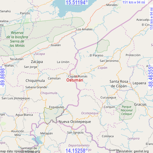
Ostumán GPS coordinates[2]
14° 49' 59.988" North, 89° 10' 0.012" West
| Map corner | latitude | longitude |
|---|---|---|
| Upper-left | 15.51194°, | -89.8698° |
| Center: | 14.83333°, | -89.16667° |
| Lower-right: | 14.15258°, | -88.46355° |
| Map W x H: | 151.1×151.1 km | = 93.9×93.9mi |
| max Lat: | 16.45° ⇑53% North |
| Ostumán: | 14.83333° |
| min Lat: | ⇓47% South 13.11667° |
| min Long | Ostumán | max Long |
| -89.23333° | -89.16667° | -83.23333° |
| W 1%⇐ | ⇒99% E |
Elevation
Elevation of Ostumán is 578 m = 1896 ft, and this is 16.8 m = 55 ft above average elevation for this country.
| Max E: |
1811 m = 5942 ft | 49.6% |
| Ostumán | 578 m 1896 ft | |
| Avg. | 561.2 m = 1841 ft | |
Min E: |
1 m = 3 ft | 50.4% |
See also: Honduras elevation on elevation.city.
Geographical zone
Ostumán is located in North Torrid zone (between Equator and Tropic of Cancer). Distance of this Northern Tropic circle is 956.6 km =594.4 mi to North.| Distance of | km | miles | from Ostumán |
|---|---|---|---|
| North Pole | 8357.8 | 5193.3 | to North |
| Arctic Circle | 5751.9 | 3574.1 | to North |
| Tropic Cancer | 956.6 | 594.4 | to North |
| Equator | 1649.3 | 1024.8 | to South |


Nearby cities:
15 places around Ostumán: (largest is in red/bold)
• Buenos Aires
30.9 km =19.2 mi,  44°
44°
• Copán
1.8 km =1.1 mi,  90°
90°
• Dulce Nombre
35.9 km =22.3 mi, 87°
• El Corpus
30.7 km =19.1 mi,  118°
118°
• La Encarnación
20.6 km =12.8 mi,  154°
154°
• La Esperanza
25.3 km =15.7 mi,  16°
16°
• La Zumbadora
35.2 km =21.9 mi,  54°
54°
• Nueva Armenia
23.4 km =14.5 mi, 17°
• Río Amarillo
15.3 km =9.5 mi,  13°
13°
• San Agustín
25.1 km =15.6 mi, 94°
• San Fernando
17.5 km =10.9 mi,  162°
162°
• San Jerónimo
35.5 km =22.1 mi,  65°
65°
• Santa Cruz
21.8 km =13.5 mi, 115°
• Santa Fe
35.9 km =22.3 mi,  191°
191°
• Santa Rita, Copan
8.1 km =5 mi,  62°
62°
Sources, notices
• [Note1] Compared only with cities in Honduras existing in our database
• [Src1] Map data: © OpenStreetMap contributors (CC-BY-SA)
• [Src2] Other city data from geonames.org with taken over terms of usage.
• [Src3] Geographical zone / Annual Mean Temperature by Robert A. Rohde @ Wikipedia
