Ojo de Agua geodata
Ojo de Agua (El Paraíso) is a populated place; located in Honduras in America/Tegucigalpa (GMT-6) time zone. With population of 2,330 people, there are 152 cities with bigger population in this country. Compared to other cities in Honduras, 87% of cities are located further ↑North; 88.4% of cities are located further ←West and 52.4% of cities have higher elevation than Ojo de Agua. Note1


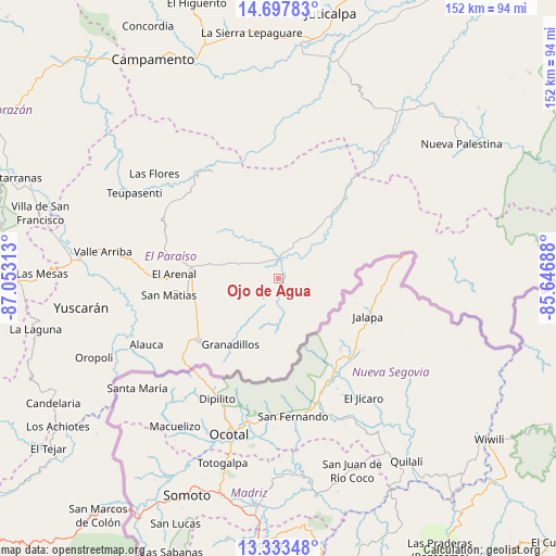
Ojo de Agua GPS coordinates[2]
14° 1' 0.012" North, 86° 21' 0" West
| Map corner | latitude | longitude |
|---|---|---|
| Upper-left | 14.69783°, | -87.05313° |
| Center: | 14.01667°, | -86.35° |
| Lower-right: | 13.33348°, | -85.64688° |
| Map W x H: | 151.7×151.7 km | = 94.3×94.3mi |
| max Lat: | 16.45° ⇑87% North |
| Ojo de Agua: | 14.01667° |
| min Lat: | ⇓13% South 13.11667° |
| min Long | Ojo de Agua | max Long |
| -89.23333° | -86.35° | -83.23333° |
| W 88.4%⇐ | ⇒11.6% E |
Elevation
Elevation of Ojo de Agua is 528 m = 1732 ft, and this is 33.2 m = 109 ft below average elevation for this country.
| Max E: |
1811 m = 5942 ft | 52.4% |
| Avg. | 561.2 m = 1841 ft | |
| Ojo de Agua | 528 m = 1732 ft | |
Min E: |
1 m = 3 ft | 47.6% |
See also: Honduras elevation on elevation.city.
Geographical zone
Ojo de Agua is located in North Torrid zone (between Equator and Tropic of Cancer). Distance of this Northern Tropic circle is 1047.4 km =650.8 mi to North.| Distance of | km | miles | from Ojo de Agua |
|---|---|---|---|
| North Pole | 8448.6 | 5249.7 | to North |
| Arctic Circle | 5842.7 | 3630.5 | to North |
| Tropic Cancer | 1047.4 | 650.8 | to North |
| Equator | 1558.5 | 968.4 | to South |


Nearby cities:
15 places around Ojo de Agua: (largest is in red/bold)
• Araulí
22.8 km =14.2 mi,  251°
251°
• Cuyalí
26.2 km =16.3 mi,  235°
235°
• Danlí
25.2 km =15.7 mi,  274°
274°
• El Benque
12.7 km =7.9 mi,  278°
278°
• El Chichicaste
7.7 km =4.8 mi,  44°
44°
• El Obraje
9.2 km =5.7 mi,  258°
258°
• El Paraíso
27.3 km =17 mi,  232°
232°
• El Pescadero
23.5 km =14.6 mi, 246°
• Jacaleapa
34.2 km =21.3 mi, 270°
• Jutiapa
6.5 km =4 mi, 235°
• Las Ánimas
34.9 km =21.7 mi,  317°
317°
• Quebrada Larga
9.4 km =5.8 mi,  349°
349°
• San Diego
13.1 km =8.1 mi,  286°
286°
• San Matías
30.8 km =19.1 mi, 263°
• Santa Cruz
34.8 km =21.6 mi, 241°
Sources, notices
• [Note1] Compared only with cities in Honduras existing in our database
• [Src1] Map data: © OpenStreetMap contributors (CC-BY-SA)
• [Src2] Other city data from geonames.org with taken over terms of usage.
• [Src3] Geographical zone / Annual Mean Temperature by Robert A. Rohde @ Wikipedia
