Nombre de Jesús geodata
Nombre de Jesús (Yoro) is a populated place; located in Honduras in America/Tegucigalpa (GMT-6) time zone. With population of 1,250 people, there are 307 cities with bigger population in this country. Compared to other cities in Honduras, 76.2% of cities are located further ↓South; 80.2% of cities are located further ←West and 55.6% of cities have higher elevation than Nombre de Jesús. Note1


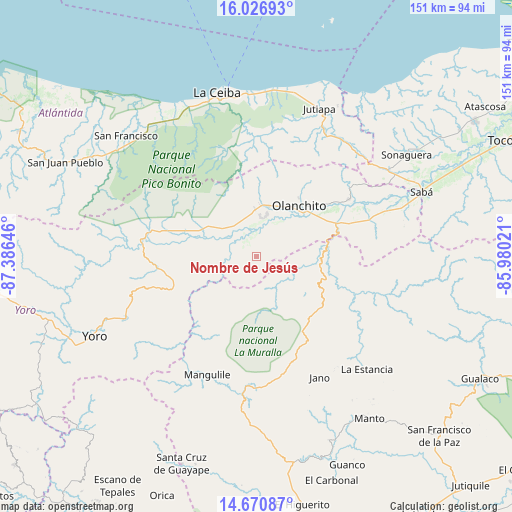
Nombre de Jesús GPS coordinates[2]
15° 21' 0" North, 86° 40' 59.988" West
| Map corner | latitude | longitude |
|---|---|---|
| Upper-left | 16.02693°, | -87.38646° |
| Center: | 15.35°, | -86.68333° |
| Lower-right: | 14.67087°, | -85.98021° |
| Map W x H: | 150.8×150.8 km | = 93.7×93.7mi |
| max Lat: | 16.45° ⇑23.8% North |
| Nombre de Jesús: | 15.35° |
| min Lat: | ⇓76.2% South 13.11667° |
| min Long | Nombre de Jesú | max Long |
| -89.23333° | -86.68333° | -83.23333° |
| W 80.2%⇐ | ⇒19.8% E |
Elevation
Elevation of Nombre de Jesús is 473 m = 1552 ft, and this is 88.2 m = 289 ft below average elevation for this country.
| Max E: |
1811 m = 5942 ft | 55.6% |
| Avg. | 561.2 m = 1841 ft | |
| Nombre de Jesús | 473 m = 1552 ft | |
Min E: |
1 m = 3 ft | 44.4% |
See also: Honduras elevation on elevation.city.
Geographical zone
Nombre de Jesús is located in North Torrid zone (between Equator and Tropic of Cancer). Distance of this Northern Tropic circle is 899.2 km =558.7 mi to North.| Distance of | km | miles | from Nombre de Jesús |
|---|---|---|---|
| North Pole | 8300.3 | 5157.6 | to North |
| Arctic Circle | 5694.4 | 3538.3 | to North |
| Tropic Cancer | 899.2 | 558.7 | to North |
| Equator | 1706.8 | 1060.6 | to South |


Nearby cities:
15 places around Nombre de Jesús: (largest is in red/bold)
• Arenal
16.1 km =10 mi,  270°
270°
• Armenia
36.3 km =22.6 mi,  69°
69°
• Buenos Aires
33 km =20.5 mi, 66°
• Chirinos
12.1 km =7.5 mi,  62°
62°
• Coyoles
13 km =8.1 mi,  0°
0°
• Coyoles Central
5.8 km =3.6 mi,  17°
17°
• El Juncal
29 km =18 mi, 67°
• El Ocote
14.5 km =9 mi, 59°
• Jocón
31.3 km =19.4 mi,  256°
256°
• La Colorada
32.9 km =20.4 mi,  334°
334°
• Mangulile
33.9 km =21.1 mi,  201°
201°
• Olanchito
18.7 km =11.6 mi,  38°
38°
• Piedras Amarillas
39.1 km =24.3 mi, 18°
• Teguajinal
9.1 km =5.7 mi,  78°
78°
• Trojas
1.8 km =1.1 mi, 270°
Sources, notices
• [Note1] Compared only with cities in Honduras existing in our database
• [Src1] Map data: © OpenStreetMap contributors (CC-BY-SA)
• [Src2] Other city data from geonames.org with taken over terms of usage.
• [Src3] Geographical zone / Annual Mean Temperature by Robert A. Rohde @ Wikipedia
