Lagunas geodata
Lagunas (Lempira) is a populated place; located in Honduras in America/Tegucigalpa (GMT-6) time zone. With population of 986 people, there are 423 cities with bigger population in this country. Compared to other cities in Honduras, 65.2% of cities are located further ↑North; 82.4% of cities are located further →East and 83.8% of cities have lower elevation than Lagunas. Note1


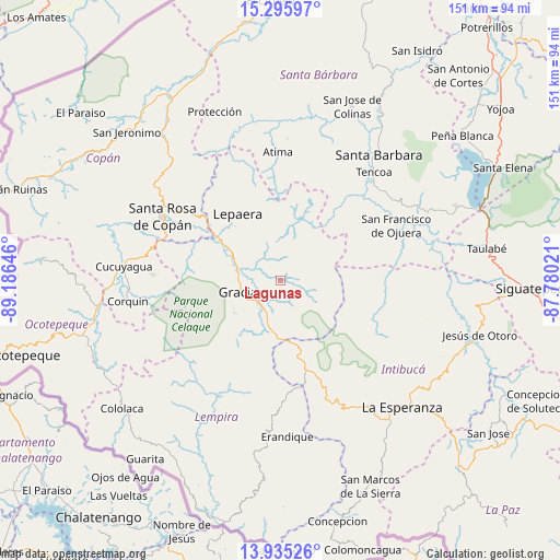
Lagunas GPS coordinates[2]
14° 37' 0.012" North, 88° 28' 59.988" West
| Map corner | latitude | longitude |
|---|---|---|
| Upper-left | 15.29597°, | -89.18646° |
| Center: | 14.61667°, | -88.48333° |
| Lower-right: | 13.93526°, | -87.78021° |
| Map W x H: | 151.3×151.3 km | = 94×94mi |
| max Lat: | 16.45° ⇑65.2% North |
| Lagunas: | 14.61667° |
| min Lat: | ⇓34.8% South 13.11667° |
| min Long | Lagunas | max Long |
| -89.23333° | -88.48333° | -83.23333° |
| W 17.6%⇐ | ⇒82.4% E |
Elevation
Elevation of Lagunas is 1008 m = 3307 ft, and this is 446.8 m = 1466 ft above average elevation for this country.
| Max E: |
1811 m = 5942 ft | 16.2% |
| Lagunas | 1008 m 3307 ft | |
| Avg. | 561.2 m = 1841 ft | |
Min E: |
1 m = 3 ft | 83.8% |
See also: Honduras elevation on elevation.city.
Geographical zone
Lagunas is located in North Torrid zone (between Equator and Tropic of Cancer). Distance of this Northern Tropic circle is 980.7 km =609.4 mi to North.| Distance of | km | miles | from Lagunas |
|---|---|---|---|
| North Pole | 8381.8 | 5208.2 | to North |
| Arctic Circle | 5776 | 3589 | to North |
| Tropic Cancer | 980.7 | 609.4 | to North |
| Equator | 1625.2 | 1009.9 | to South |


Nearby cities:
15 places around Lagunas: (largest is in red/bold)
• Arada
32.6 km =20.3 mi,  37°
37°
• Atima
35.2 km =21.9 mi,  0°
0°
• Berlín
24.2 km =15 mi,  355°
355°
• El Derrumbo
35.5 km =22.1 mi,  294°
294°
• El Níspero
23.2 km =14.4 mi, 44°
• Gracias
11 km =6.8 mi,  254°
254°
• La Laguna del Pedernal
24 km =14.9 mi,  338°
338°
• La Libertad
23 km =14.3 mi,  332°
332°
• La Unión
24 km =14.9 mi,  21°
21°
• Las Tejeras
23.9 km =14.9 mi, 328°
• Lepaera
21.4 km =13.3 mi, 329°
• San Francisco de Ojuera
35.5 km =22.1 mi,  65°
65°
• San Juan de Opoa
29.8 km =18.5 mi,  308°
308°
• Santa Rosa de Copán
35.9 km =22.3 mi,  297°
297°
• Taragual
14.8 km =9.2 mi, 0°
Sources, notices
• [Note1] Compared only with cities in Honduras existing in our database
• [Src1] Map data: © OpenStreetMap contributors (CC-BY-SA)
• [Src2] Other city data from geonames.org with taken over terms of usage.
• [Src3] Geographical zone / Annual Mean Temperature by Robert A. Rohde @ Wikipedia
