Jícaro Galán geodata
Jícaro Galán (Valle) is a populated place; located in Honduras in America/Tegucigalpa (GMT-6) time zone. With population of 1,370 people, there are 271 cities with bigger population in this country. Compared to other cities in Honduras, 94.4% of cities are located further ↑North; 56.8% of cities are located further ←West and 82.2% of cities have higher elevation than Jícaro Galán. Note1


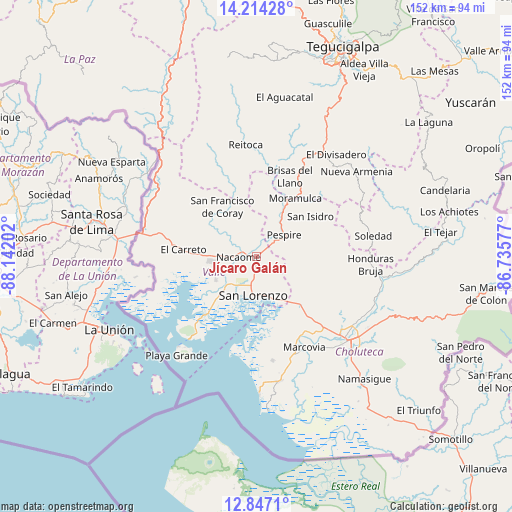
Jícaro Galán GPS coordinates[2]
13° 31' 54.012" North, 87° 26' 20.004" West
| Map corner | latitude | longitude |
|---|---|---|
| Upper-left | 14.21428°, | -88.14202° |
| Center: | 13.53167°, | -87.43889° |
| Lower-right: | 12.8471°, | -86.73577° |
| Map W x H: | 152×152 km | = 94.4×94.4mi |
| max Lat: | 16.45° ⇑94.4% North |
| Jícaro Galán: | 13.53167° |
| min Lat: | ⇓5.6% South 13.11667° |
| min Long | Jícaro Galán | max Long |
| -89.23333° | -87.43889° | -83.23333° |
| W 56.8%⇐ | ⇒43.2% E |
Elevation
Elevation of Jícaro Galán is 55 m = 180 ft, and this is 506.2 m = 1661 ft below average elevation for this country.
| Max E: |
1811 m = 5942 ft | 82.2% |
| Avg. | 561.2 m = 1841 ft | |
| Jícaro Galán | 55 m = 180 ft | |
Min E: |
1 m = 3 ft | 17.8% |
See also: Honduras elevation on elevation.city.
Geographical zone
Jícaro Galán is located in North Torrid zone (between Equator and Tropic of Cancer). Distance of this Northern Tropic circle is 1101.3 km =684.3 mi to North.| Distance of | km | miles | from Jícaro Galán |
|---|---|---|---|
| North Pole | 8502.5 | 5283.2 | to North |
| Arctic Circle | 5896.6 | 3664 | to North |
| Tropic Cancer | 1101.3 | 684.3 | to North |
| Equator | 1504.6 | 934.9 | to South |


Nearby cities:
15 places around Jícaro Galán: (largest is in red/bold)
• Agua Caliente de Linaca
24.8 km =15.4 mi,  115°
115°
• Agua Fría
14 km =8.7 mi,  240°
240°
• El Cubolero
25.7 km =16 mi,  253°
253°
• El Guapinol
26.3 km =16.3 mi,  353°
353°
• El Guayabo
4.7 km =2.9 mi,  186°
186°
• El Porvenir
27.5 km =17.1 mi,  21°
21°
• El Tular
11 km =6.8 mi,  228°
228°
• Goascorán
20.1 km =12.5 mi,  286°
286°
• La Criba
9.1 km =5.7 mi,  162°
162°
• Langue
25.1 km =15.6 mi, 293°
• Nacaome
5.3 km =3.3 mi,  275°
275°
• Pespire
10.7 km =6.6 mi,  51°
51°
• San Francisco de Coray
17.6 km =10.9 mi,  324°
324°
• San José de Las Conchas
23.4 km =14.5 mi,  168°
168°
• San Lorenzo
12 km =7.5 mi,  184°
184°
Sources, notices
• [Note1] Compared only with cities in Honduras existing in our database
• [Src1] Map data: © OpenStreetMap contributors (CC-BY-SA)
• [Src2] Other city data from geonames.org with taken over terms of usage.
• [Src3] Geographical zone / Annual Mean Temperature by Robert A. Rohde @ Wikipedia
