El Porvenir geodata
El Porvenir (Francisco Morazán) is a populated place; located in Honduras in America/Tegucigalpa (GMT-6) time zone. With population of 3,153 people, there are 102 cities with bigger population in this country. Compared to other cities in Honduras, 91.8% of cities are located further ↑North; 60.4% of cities are located further ←West and 50.8% of cities have higher elevation than El Porvenir. Note1


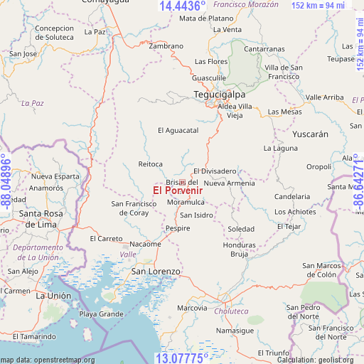
El Porvenir GPS coordinates[2]
13° 45' 42.012" North, 87° 20' 44.988" West
| Map corner | latitude | longitude |
|---|---|---|
| Upper-left | 14.4436°, | -88.04896° |
| Center: | 13.76167°, | -87.34583° |
| Lower-right: | 13.07775°, | -86.64271° |
| Map W x H: | 151.9×151.9 km | = 94.4×94.4mi |
| max Lat: | 16.45° ⇑91.8% North |
| El Porvenir: | 13.76167° |
| min Lat: | ⇓8.2% South 13.11667° |
| min Long | El Porvenir | max Long |
| -89.23333° | -87.34583° | -83.23333° |
| W 60.4%⇐ | ⇒39.6% E |
Elevation
Elevation of El Porvenir is 556 m = 1824 ft, and this is 5.2 m = 17 ft below average elevation for this country.
| Max E: |
1811 m = 5942 ft | 50.8% |
| Avg. | 561.2 m = 1841 ft | |
| El Porvenir | 556 m = 1824 ft | |
Min E: |
1 m = 3 ft | 49.2% |
See also: Honduras elevation on elevation.city.
Geographical zone
El Porvenir is located in North Torrid zone (between Equator and Tropic of Cancer). Distance of this Northern Tropic circle is 1075.8 km =668.5 mi to North.| Distance of | km | miles | from El Porvenir |
|---|---|---|---|
| North Pole | 8476.9 | 5267.3 | to North |
| Arctic Circle | 5871 | 3648.1 | to North |
| Tropic Cancer | 1075.8 | 668.5 | to North |
| Equator | 1530.2 | 950.8 | to South |


Nearby cities:
15 places around El Porvenir: (largest is in red/bold)
• Alubarén
13.8 km =8.6 mi,  286°
286°
• Cerro Grande
12 km =7.5 mi,  59°
59°
• El Guapinol
13.1 km =8.1 mi,  272°
272°
• El Guayabo
32.1 km =19.9 mi,  199°
199°
• El Tizatillo
31 km =19.3 mi,  31°
31°
• Jícaro Galán
27.5 km =17.1 mi, 201°
• Las Tapias
34.6 km =21.5 mi,  11°
11°
• Nacaome
29.4 km =18.3 mi,  211°
211°
• Ojojona
19.9 km =12.4 mi,  15°
15°
• Pespire
18.9 km =11.7 mi,  185°
185°
• Reitoca
14.7 km =9.1 mi,  298°
298°
• Sabanagrande
10.7 km =6.6 mi, 61°
• San Francisco de Coray
23.1 km =14.4 mi,  241°
241°
• Santa Ana
20.5 km =12.7 mi, 23°
• Yaguacire
31.6 km =19.6 mi, 26°
Sources, notices
• [Note1] Compared only with cities in Honduras existing in our database
• [Src1] Map data: © OpenStreetMap contributors (CC-BY-SA)
• [Src2] Other city data from geonames.org with taken over terms of usage.
• [Src3] Geographical zone / Annual Mean Temperature by Robert A. Rohde @ Wikipedia
