El Rodeo geodata
El Rodeo (El Paraíso) is a populated place; located in Honduras in America/Tegucigalpa (GMT-6) time zone. With population of 893 people, there are 483 cities with bigger population in this country. Compared to other cities in Honduras, 78.4% of cities are located further ↑North; 82.2% of cities are located further ←West and 69% of cities have lower elevation than El Rodeo. Note1


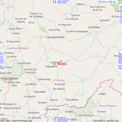
El Rodeo GPS coordinates[2]
14° 16' 59.988" North, 86° 36' 0" West
| Map corner | latitude | longitude |
|---|---|---|
| Upper-left | 14.96367°, | -87.30313° |
| Center: | 14.28333°, | -86.6° |
| Lower-right: | 13.60092°, | -85.89688° |
| Map W x H: | 151.5×151.5 km | = 94.1×94.1mi |
| max Lat: | 16.45° ⇑78.4% North |
| El Rodeo: | 14.28333° |
| min Lat: | ⇓21.6% South 13.11667° |
| min Long | El Rodeo | max Long |
| -89.23333° | -86.6° | -83.23333° |
| W 82.2%⇐ | ⇒17.8% E |
Elevation
Elevation of El Rodeo is 763 m = 2503 ft, and this is 201.8 m = 662 ft above average elevation for this country.
| Max E: |
1811 m = 5942 ft | 31% |
| El Rodeo | 763 m 2503 ft | |
| Avg. | 561.2 m = 1841 ft | |
Min E: |
1 m = 3 ft | 69% |
See also: Honduras elevation on elevation.city.
Geographical zone
El Rodeo is located in North Torrid zone (between Equator and Tropic of Cancer). Distance of this Northern Tropic circle is 1017.8 km =632.4 mi to North.| Distance of | km | miles | from El Rodeo |
|---|---|---|---|
| North Pole | 8418.9 | 5231.3 | to North |
| Arctic Circle | 5813 | 3612 | to North |
| Tropic Cancer | 1017.8 | 632.4 | to North |
| Equator | 1588.2 | 986.9 | to South |


Nearby cities:
15 places around El Rodeo: (largest is in red/bold)
• Araulí
37.5 km =23.3 mi,  171°
171°
• Campamento
30.1 km =18.7 mi,  349°
349°
• Danlí
27.9 km =17.3 mi,  176°
176°
• El Benque
31.3 km =19.4 mi,  152°
152°
• El Obraje
36.3 km =22.6 mi, 150°
• El Rusio
32.4 km =20.1 mi,  50°
50°
• Guaimaca
36.3 km =22.6 mi,  319°
319°
• Jacaleapa
30.5 km =19 mi,  193°
193°
• Las Ánimas
5.2 km =3.2 mi,  135°
135°
• Morocelí
34.2 km =21.3 mi,  237°
237°
• Quebrada Larga
32.4 km =20.1 mi,  129°
129°
• Sabana Abajo
35.3 km =21.9 mi,  2°
2°
• San Diego
29.7 km =18.5 mi, 151°
• San Matías
33.5 km =20.8 mi, 186°
• Teupasenti
13.1 km =8.1 mi, 235°
Sources, notices
• [Note1] Compared only with cities in Honduras existing in our database
• [Src1] Map data: © OpenStreetMap contributors (CC-BY-SA)
• [Src2] Other city data from geonames.org with taken over terms of usage.
• [Src3] Geographical zone / Annual Mean Temperature by Robert A. Rohde @ Wikipedia
