El Pino geodata
El Pino (Atlántida) is a populated place; located in Honduras in America/Tegucigalpa (GMT-6) time zone. With population of 3,004 people, there are 110 cities with bigger population in this country. Compared to other cities in Honduras, 91.6% of cities are located further ↓South; 76.2% of cities are located further ←West and 88% of cities have higher elevation than El Pino. Note1


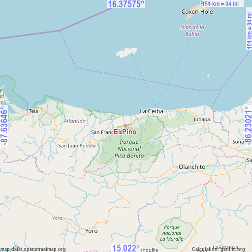
El Pino GPS coordinates[2]
15° 42' 0" North, 86° 55' 59.988" West
| Map corner | latitude | longitude |
|---|---|---|
| Upper-left | 16.37575°, | -87.63646° |
| Center: | 15.7°, | -86.93333° |
| Lower-right: | 15.022°, | -86.23021° |
| Map W x H: | 150.5×150.5 km | = 93.5×93.5mi |
| max Lat: | 16.45° ⇑8.4% North |
| El Pino: | 15.7° |
| min Lat: | ⇓91.6% South 13.11667° |
| min Long | El Pino | max Long |
| -89.23333° | -86.93333° | -83.23333° |
| W 76.2%⇐ | ⇒23.8% E |
Elevation
Elevation of El Pino is 32 m = 105 ft, and this is 529.2 m = 1736 ft below average elevation for this country.
| Max E: |
1811 m = 5942 ft | 88% |
| Avg. | 561.2 m = 1841 ft | |
| El Pino | 32 m = 105 ft | |
Min E: |
1 m = 3 ft | 12% |
See also: Honduras elevation on elevation.city.
Geographical zone
El Pino is located in North Torrid zone (between Equator and Tropic of Cancer). Distance of this Northern Tropic circle is 860.2 km =534.5 mi to North.| Distance of | km | miles | from El Pino |
|---|---|---|---|
| North Pole | 8261.4 | 5133.4 | to North |
| Arctic Circle | 5655.5 | 3514.2 | to North |
| Tropic Cancer | 860.2 | 534.5 | to North |
| Equator | 1745.7 | 1084.7 | to South |


Nearby cities:
15 places around El Pino: (largest is in red/bold)
• Arenal
40.4 km =25.1 mi,  164°
164°
• Atenas de San Cristóbal
41.1 km =25.5 mi,  267°
267°
• Corozal
25.7 km =16 mi,  64°
64°
• Coyoles
37.3 km =23.2 mi,  134°
134°
• El Porvenir
5.6 km =3.5 mi,  0°
0°
• La Ceiba
17.5 km =10.9 mi,  67°
67°
• La Colorada
15.6 km =9.7 mi, 126°
• La Masica
21.7 km =13.5 mi,  244°
244°
• La Unión
7.4 km =4.6 mi,  284°
284°
• Piedras Amarillas
39.3 km =24.4 mi,  92°
92°
• Sambo Creek
29.7 km =18.5 mi, 64°
• San Antonio
25.7 km =16 mi, 244°
• San Francisco
13.7 km =8.5 mi,  246°
246°
• San Juan Pueblo
34.6 km =21.5 mi, 248°
• Santa Ana
15.3 km =9.5 mi, 248°
Sources, notices
• [Note1] Compared only with cities in Honduras existing in our database
• [Src1] Map data: © OpenStreetMap contributors (CC-BY-SA)
• [Src2] Other city data from geonames.org with taken over terms of usage.
• [Src3] Geographical zone / Annual Mean Temperature by Robert A. Rohde @ Wikipedia
