San Antonio geodata
San Antonio (Atlántida) is a populated place; located in Honduras in America/Tegucigalpa (GMT-6) time zone. With population of 1,151 people, there are 334 cities with bigger population in this country. Compared to other cities in Honduras, 88% of cities are located further ↓South; 67.8% of cities are located further ←West and 78.2% of cities have higher elevation than San Antonio. Note1


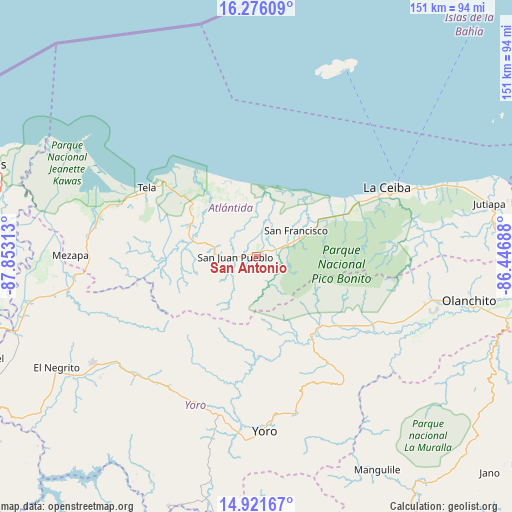
San Antonio GPS coordinates[2]
15° 36' 0" North, 87° 9' 0" West
| Map corner | latitude | longitude |
|---|---|---|
| Upper-left | 16.27609°, | -87.85313° |
| Center: | 15.6°, | -87.15° |
| Lower-right: | 14.92167°, | -86.44688° |
| Map W x H: | 150.6×150.6 km | = 93.6×93.6mi |
| max Lat: | 16.45° ⇑12% North |
| San Antonio: | 15.6° |
| min Lat: | ⇓88% South 13.11667° |
| min Long | San Antonio | max Long |
| -89.23333° | -87.15° | -83.23333° |
| W 67.8%⇐ | ⇒32.2% E |
Elevation
Elevation of San Antonio is 98 m = 322 ft, and this is 463.2 m = 1520 ft below average elevation for this country.
| Max E: |
1811 m = 5942 ft | 78.2% |
| Avg. | 561.2 m = 1841 ft | |
| San Antonio | 98 m = 322 ft | |
Min E: |
1 m = 3 ft | 21.8% |
See also: Honduras elevation on elevation.city.
Geographical zone
San Antonio is located in North Torrid zone (between Equator and Tropic of Cancer). Distance of this Northern Tropic circle is 871.4 km =541.5 mi to North.| Distance of | km | miles | from San Antonio |
|---|---|---|---|
| North Pole | 8272.5 | 5140.3 | to North |
| Arctic Circle | 5666.6 | 3521.1 | to North |
| Tropic Cancer | 871.4 | 541.5 | to North |
| Equator | 1734.6 | 1077.8 | to South |


Nearby cities:
15 places around San Antonio: (largest is in red/bold)
• Arizona
18.2 km =11.3 mi,  281°
281°
• Atenas de San Cristóbal
20.1 km =12.5 mi,  297°
297°
• El Pino
25.7 km =16 mi,  64°
64°
• El Porvenir
28.6 km =17.8 mi,  54°
54°
• Hicaque
26.6 km =16.5 mi, 299°
• La Masica
4 km =2.5 mi, 62°
• La Rosa
29.2 km =18.1 mi,  162°
162°
• La Unión
20.6 km =12.8 mi, 51°
• Matarras
28.3 km =17.6 mi,  250°
250°
• Mezapa
25.6 km =15.9 mi,  257°
257°
• San Antonio
29.7 km =18.5 mi,  180°
180°
• San Francisco
12.1 km =7.5 mi, 62°
• San José
31.6 km =19.6 mi, 183°
• San Juan Pueblo
9.1 km =5.7 mi, 258°
• Santa Ana
10.5 km =6.5 mi, 58°
Sources, notices
• [Note1] Compared only with cities in Honduras existing in our database
• [Src1] Map data: © OpenStreetMap contributors (CC-BY-SA)
• [Src2] Other city data from geonames.org with taken over terms of usage.
• [Src3] Geographical zone / Annual Mean Temperature by Robert A. Rohde @ Wikipedia
