El Porvenir geodata
El Porvenir (Atlántida) is a populated place; located in Honduras in America/Tegucigalpa (GMT-6) time zone. With population of 2,269 people, there are 157 cities with bigger population in this country. Compared to other cities in Honduras, 93% of cities are located further ↓South; 76.2% of cities are located further ←West and 95.2% of cities have higher elevation than El Porvenir. Note1


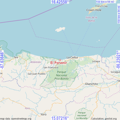
El Porvenir GPS coordinates[2]
15° 45' 0" North, 86° 55' 59.988" West
| Map corner | latitude | longitude |
|---|---|---|
| Upper-left | 16.42558°, | -87.63646° |
| Center: | 15.75°, | -86.93333° |
| Lower-right: | 15.07216°, | -86.23021° |
| Map W x H: | 150.5×150.5 km | = 93.5×93.5mi |
| max Lat: | 16.45° ⇑7% North |
| El Porvenir: | 15.75° |
| min Lat: | ⇓93% South 13.11667° |
| min Long | El Porvenir | max Long |
| -89.23333° | -86.93333° | -83.23333° |
| W 76.2%⇐ | ⇒23.8% E |
Elevation
Elevation of El Porvenir is 10 m = 33 ft, and this is 551.2 m = 1808 ft below average elevation for this country.
| Max E: |
1811 m = 5942 ft | 95.2% |
| Avg. | 561.2 m = 1841 ft | |
| El Porvenir | 10 m = 33 ft | |
Min E: |
1 m = 3 ft | 4.8% |
See also: Honduras elevation on elevation.city.
Geographical zone
El Porvenir is located in North Torrid zone (between Equator and Tropic of Cancer). Distance of this Northern Tropic circle is 854.7 km =531.1 mi to North.| Distance of | km | miles | from El Porvenir |
|---|---|---|---|
| North Pole | 8255.8 | 5129.9 | to North |
| Arctic Circle | 5649.9 | 3510.7 | to North |
| Tropic Cancer | 854.7 | 531.1 | to North |
| Equator | 1751.2 | 1088.1 | to South |


Nearby cities:
15 places around El Porvenir: (largest is in red/bold)
• Arizona
43 km =26.7 mi,  252°
252°
• Atenas de San Cristóbal
41.7 km =25.9 mi,  259°
259°
• Corozal
23.8 km =14.8 mi,  76°
76°
• Coyoles
41.3 km =25.7 mi,  139°
139°
• El Pino
5.6 km =3.5 mi,  180°
180°
• La Ceiba
16.2 km =10.1 mi,  86°
86°
• La Colorada
19.4 km =12.1 mi, 139°
• La Masica
24.6 km =15.3 mi,  232°
232°
• La Unión
8 km =5 mi,  242°
242°
• Piedras Amarillas
39.9 km =24.8 mi,  100°
100°
• Sambo Creek
27.8 km =17.3 mi,  74°
74°
• San Antonio
28.6 km =17.8 mi, 234°
• San Francisco
16.7 km =10.4 mi, 228°
• San Juan Pueblo
37.1 km =23.1 mi, 240°
• Santa Ana
18.1 km =11.2 mi, 232°
Sources, notices
• [Note1] Compared only with cities in Honduras existing in our database
• [Src1] Map data: © OpenStreetMap contributors (CC-BY-SA)
• [Src2] Other city data from geonames.org with taken over terms of usage.
• [Src3] Geographical zone / Annual Mean Temperature by Robert A. Rohde @ Wikipedia
