San Juan Pueblo geodata
San Juan Pueblo (Atlántida) is a populated place; located in Honduras in America/Tegucigalpa (GMT-6) time zone. With population of 5,735 people, there are 55 cities with bigger population in this country. Compared to other cities in Honduras, 87% of cities are located further ↓South; 65% of cities are located further ←West and 73.6% of cities have higher elevation than San Juan Pueblo. Note1


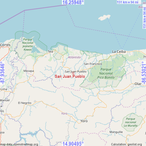
San Juan Pueblo GPS coordinates[2]
15° 34' 59.988" North, 87° 13' 59.988" West
| Map corner | latitude | longitude |
|---|---|---|
| Upper-left | 16.25948°, | -87.93646° |
| Center: | 15.58333°, | -87.23333° |
| Lower-right: | 14.90495°, | -86.53021° |
| Map W x H: | 150.6×150.6 km | = 93.6×93.6mi |
| max Lat: | 16.45° ⇑13% North |
| San Juan Pueblo: | 15.58333° |
| min Lat: | ⇓87% South 13.11667° |
| min Long | San Juan Pueblo | max Long |
| -89.23333° | -87.23333° | -83.23333° |
| W 65%⇐ | ⇒35% E |
Elevation
Elevation of San Juan Pueblo is 171 m = 561 ft, and this is 390.2 m = 1280 ft below average elevation for this country.
| Max E: |
1811 m = 5942 ft | 73.6% |
| Avg. | 561.2 m = 1841 ft | |
| San Juan Pueblo | 171 m = 561 ft | |
Min E: |
1 m = 3 ft | 26.4% |
See also: Honduras elevation on elevation.city.
Geographical zone
San Juan Pueblo is located in North Torrid zone (between Equator and Tropic of Cancer). Distance of this Northern Tropic circle is 873.2 km =542.6 mi to North.| Distance of | km | miles | from San Juan Pueblo |
|---|---|---|---|
| North Pole | 8274.4 | 5141.5 | to North |
| Arctic Circle | 5668.5 | 3522.2 | to North |
| Tropic Cancer | 873.2 | 542.6 | to North |
| Equator | 1732.7 | 1076.6 | to South |


Nearby cities:
15 places around San Juan Pueblo: (largest is in red/bold)
• Arizona
10.5 km =6.5 mi,  301°
301°
• Atenas de San Cristóbal
14.3 km =8.9 mi,  321°
321°
• El Triunfo de la Cruz
29.6 km =18.4 mi,  313°
313°
• Hicaque
20.6 km =12.8 mi, 316°
• La Masica
13 km =8.1 mi,  73°
73°
• La Rosa
31.5 km =19.6 mi,  145°
145°
• La Unión
29.1 km =18.1 mi,  59°
59°
• Matarras
19.3 km =12 mi,  247°
247°
• Mezapa
16.5 km =10.3 mi,  257°
257°
• Nueva Florida
31.4 km =19.5 mi, 245°
• San Antonio
9.1 km =5.7 mi,  78°
78°
• San Antonio
29.2 km =18.1 mi,  162°
162°
• San Francisco
21 km =13 mi, 69°
• San José
30.5 km =19 mi,  166°
166°
• Santa Ana
19.3 km =12 mi, 67°
Sources, notices
• [Note1] Compared only with cities in Honduras existing in our database
• [Src1] Map data: © OpenStreetMap contributors (CC-BY-SA)
• [Src2] Other city data from geonames.org with taken over terms of usage.
• [Src3] Geographical zone / Annual Mean Temperature by Robert A. Rohde @ Wikipedia
