Camalote geodata
Camalote (Santa Bárbara) is a populated place; located in Honduras in America/Tegucigalpa (GMT-6) time zone. With population of 1,319 people, there are 284 cities with bigger population in this country. Compared to other cities in Honduras, 75.2% of cities are located further ↓South; 79.2% of cities are located further →East and 71.8% of cities have higher elevation than Camalote. Note1


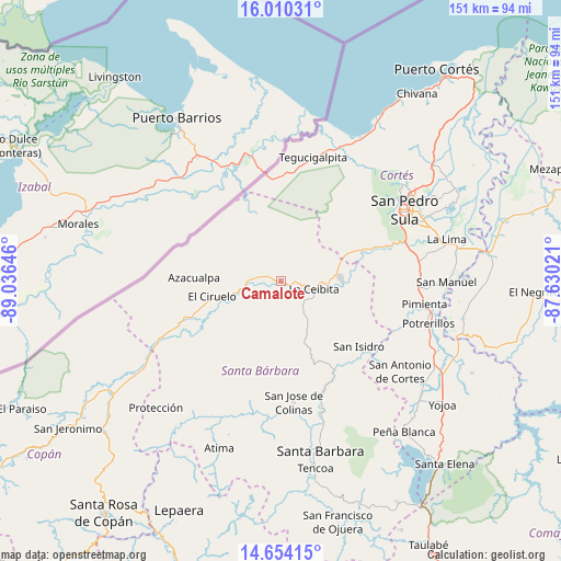
Camalote GPS coordinates[2]
15° 19' 59.988" North, 88° 19' 59.988" West
| Map corner | latitude | longitude |
|---|---|---|
| Upper-left | 16.01031°, | -89.03646° |
| Center: | 15.33333°, | -88.33333° |
| Lower-right: | 14.65415°, | -87.63021° |
| Map W x H: | 150.8×150.8 km | = 93.7×93.7mi |
| max Lat: | 16.45° ⇑24.8% North |
| Camalote: | 15.33333° |
| min Lat: | ⇓75.2% South 13.11667° |
| min Long | Camalote | max Long |
| -89.23333° | -88.33333° | -83.23333° |
| W 20.8%⇐ | ⇒79.2% E |
Elevation
Elevation of Camalote is 201 m = 659 ft, and this is 360.2 m = 1182 ft below average elevation for this country.
| Max E: |
1811 m = 5942 ft | 71.8% |
| Avg. | 561.2 m = 1841 ft | |
| Camalote | 201 m = 659 ft | |
Min E: |
1 m = 3 ft | 28.2% |
See also: Honduras elevation on elevation.city.
Geographical zone
Camalote is located in North Torrid zone (between Equator and Tropic of Cancer). Distance of this Northern Tropic circle is 901 km =559.9 mi to North.| Distance of | km | miles | from Camalote |
|---|---|---|---|
| North Pole | 8302.2 | 5158.7 | to North |
| Arctic Circle | 5696.3 | 3539.5 | to North |
| Tropic Cancer | 901 | 559.9 | to North |
| Equator | 1704.9 | 1059.4 | to South |


Nearby cities:
15 places around Camalote: (largest is in red/bold)
• Buenos Aires
23.2 km =14.4 mi,  43°
43°
• Cofradía
21 km =13 mi,  69°
69°
• Correderos
15.6 km =9.7 mi,  306°
306°
• El Ciruelo
18.3 km =11.4 mi,  258°
258°
• La Esperanza
18.6 km =11.6 mi,  60°
60°
• La Flecha
17 km =10.6 mi,  250°
250°
• Laguna Verde
23.2 km =14.4 mi,  129°
129°
• Naco
17 km =10.6 mi, 70°
• Petoa
9.1 km =5.7 mi,  144°
144°
• Pinalejo
9.1 km =5.7 mi, 307°
• Potrerillos
13 km =8.1 mi,  235°
235°
• Quimistán
7.4 km =4.6 mi,  284°
284°
• San Marcos
9.7 km =6 mi, 247°
• Santa Cruz Minas
5.1 km =3.2 mi, 43°
• Santa Elena
22.2 km =13.8 mi,  75°
75°
Sources, notices
• [Note1] Compared only with cities in Honduras existing in our database
• [Src1] Map data: © OpenStreetMap contributors (CC-BY-SA)
• [Src2] Other city data from geonames.org with taken over terms of usage.
• [Src3] Geographical zone / Annual Mean Temperature by Robert A. Rohde @ Wikipedia
