Gvozd geodata
Gvozd (Sisačko-Moslavačka) is a seat of a second-order administrative division; located in Croatia in Europe/Zagreb (GMT+2) time zone. With population of 1,309 people, there are 339 cities with bigger population in this country. Compared to other cities in Croatia, 55.4% of cities are located further ↑North; 72.8% of cities are located further →East and 52.4% of cities have lower elevation than Gvozd. Note1


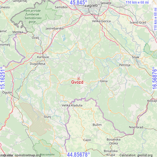
Gvozd GPS coordinates[2]
45° 21' 10.98" North, 15° 51' 56.268" East
| Map corner | latitude | longitude |
|---|---|---|
| Upper-left | 45.845°, | 15.16251° |
| Center: | 45.35305°, | 15.86563° |
| Lower-right: | 44.85678°, | 16.56876° |
| Map W x H: | 109.9×109.9 km | = 68.3×68.3mi |
| max Lat: | 46.52694° ⇑55.4% North |
| Gvozd: | 45.35305° |
| min Lat: | ⇓44.6% South 42.54972° |
| min Long | Gvozd | max Long |
| 13.52389° | 15.86563° | 19.37694° |
| W 27.2%⇐ | ⇒72.8% E |
Elevation
Elevation of Gvozd is 131 m = 430 ft, and this is 22.3 m = 73 ft below average elevation for this country.
| Max E: |
827 m = 2713 ft | 47.6% |
| Avg. | 153.3 m = 503 ft | |
| Gvozd | 131 m = 430 ft | |
Min E: |
-1 m = -3 ft | 52.4% |
See also: Croatia elevation on elevation.city.
Geographical zone
Gvozd is located in North temperate zone (between Tropic of Cancer and the Arctic Circle). Distance of this North polar circle is 2358.4 km =1465.4 mi to North.| Distance of | km | miles | from Gvozd |
|---|---|---|---|
| North Pole | 4964.3 | 3084.7 | to North |
| Arctic Circle | 2358.4 | 1465.4 | to North |
| Tropic Cancer | 2436.9 | 1514.2 | to South |
| Equator | 5042.8 | 3133.4 | to South |


Nearby cities:
15 places around Gvozd: (largest is in red/bold)
• Barilović
24.9 km =15.5 mi,  277°
277°
• Cetingrad
23.7 km =14.7 mi,  204°
204°
• Donja Kupčina
22.4 km =13.9 mi,  349°
349°
• Glina
17.5 km =10.9 mi,  95°
95°
• Karlovac
29.1 km =18.1 mi,  302°
302°
• Krnjak
20.9 km =13 mi,  263°
263°
• Lasinja
18.3 km =11.4 mi,  2°
2°
• Lasinja
19.5 km =12.1 mi,  358°
358°
• Pisarovina
25.9 km =16.1 mi, 358°
• Pokupsko
17.9 km =11.1 mi,  33°
33°
• Rečica
23.7 km =14.7 mi,  318°
318°
• Topusko
10.7 km =6.6 mi,  128°
128°
• Tušilović
20 km =12.4 mi, 284°
• Vodostaj
28 km =17.4 mi,  307°
307°
• Vojnić
13.5 km =8.4 mi, 255°
Sources, notices
• [Note1] Compared only with cities in Croatia existing in our database
• [Src1] Map data: © OpenStreetMap contributors (CC-BY-SA)
• [Src2] Other city data from geonames.org with taken over terms of usage.
• [Src3] Geographical zone / Annual Mean Temperature by Robert A. Rohde @ Wikipedia
