Višnjevac geodata
Višnjevac (Osječko-Baranjska) is a populated place; located in Croatia in Europe/Zagreb (GMT+2) time zone. With population of 6,680 people, there are 59 cities with bigger population in this country. Compared to other cities in Croatia, 56.9% of cities are located further ↓South; 92.2% of cities are located further ←West and 79.3% of cities have higher elevation than Višnjevac. Note1


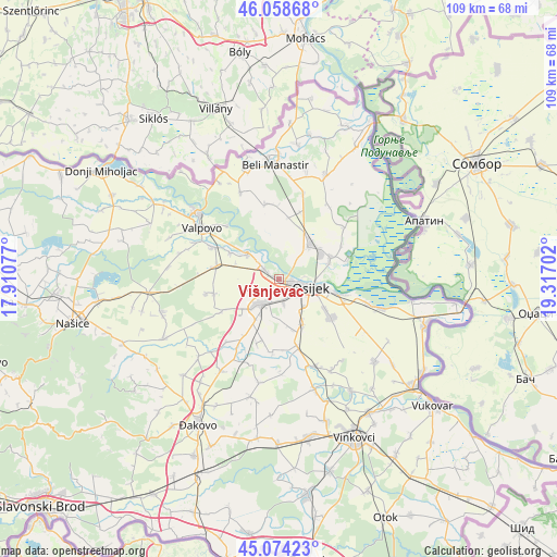
Višnjevac GPS coordinates[2]
45° 34' 6.996" North, 18° 36' 50.004" East
| Map corner | latitude | longitude |
|---|---|---|
| Upper-left | 46.05868°, | 17.91077° |
| Center: | 45.56861°, | 18.61389° |
| Lower-right: | 45.07423°, | 19.31702° |
| Map W x H: | 109.5×109.5 km | = 68×68mi |
| max Lat: | 46.52694° ⇑43.1% North |
| Višnjevac: | 45.56861° |
| min Lat: | ⇓56.9% South 42.54972° |
| min Long | Višnjevac | max Long |
| 13.52389° | 18.61389° | 19.37694° |
| W 92.2%⇐ | ⇒7.8% E |
Elevation
Elevation of Višnjevac is 86 m = 282 ft, and this is 67.3 m = 221 ft below average elevation for this country.
| Max E: |
827 m = 2713 ft | 79.3% |
| Avg. | 153.3 m = 503 ft | |
| Višnjevac | 86 m = 282 ft | |
Min E: |
-1 m = -3 ft | 20.7% |
See also: Croatia elevation on elevation.city.
Geographical zone
Višnjevac is located in North temperate zone (between Tropic of Cancer and the Arctic Circle). Distance of this North polar circle is 2334.4 km =1450.5 mi to North.| Distance of | km | miles | from Višnjevac |
|---|---|---|---|
| North Pole | 4940.3 | 3069.8 | to North |
| Arctic Circle | 2334.4 | 1450.5 | to North |
| Tropic Cancer | 2460.8 | 1529.1 | to South |
| Equator | 5066.8 | 3148.4 | to South |


Nearby cities:
15 places around Višnjevac: (largest is in red/bold)
• Antunovac
9.9 km =6.2 mi,  151°
151°
• Bilje
11 km =6.8 mi,  67°
67°
• Bizovac
12.4 km =7.7 mi,  282°
282°
• Brijest
7 km =4.3 mi,  139°
139°
• Darda
9.4 km =5.8 mi,  45°
45°
• Josipovac
3 km =1.9 mi,  301°
301°
• Livana
4.6 km =2.9 mi,  192°
192°
• Mece
10 km =6.2 mi,  56°
56°
• Osijek
6.5 km =4 mi,  107°
107°
• Petrijevci
7.8 km =4.8 mi,  308°
308°
• Samatovci
9.1 km =5.7 mi,  289°
289°
• Satnica
10.9 km =6.8 mi, 297°
• Tvrđavica
4.8 km =3 mi,  86°
86°
• Uglješ
11.1 km =6.9 mi,  19°
19°
• Čepin
6.4 km =4 mi,  218°
218°
Sources, notices
• [Note1] Compared only with cities in Croatia existing in our database
• [Src1] Map data: © OpenStreetMap contributors (CC-BY-SA)
• [Src2] Other city data from geonames.org with taken over terms of usage.
• [Src3] Geographical zone / Annual Mean Temperature by Robert A. Rohde @ Wikipedia
