Topolovac geodata
Topolovac (Sisačko-Moslavačka) is a populated place; located in Croatia in Europe/Zagreb (GMT+2) time zone. With population of 897 people, there are 528 cities with bigger population in this country. Compared to other cities in Croatia, 51.4% of cities are located further ↓South; 50.9% of cities are located further →East and 68.8% of cities have higher elevation than Topolovac. Note1


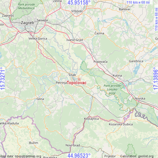
Topolovac GPS coordinates[2]
45° 27' 38.016" North, 16° 26' 8.988" East
| Map corner | latitude | longitude |
|---|---|---|
| Upper-left | 45.95158°, | 15.73271° |
| Center: | 45.46056°, | 16.43583° |
| Lower-right: | 44.96523°, | 17.13896° |
| Map W x H: | 109.7×109.7 km | = 68.2×68.2mi |
| max Lat: | 46.52694° ⇑48.6% North |
| Topolovac: | 45.46056° |
| min Lat: | ⇓51.4% South 42.54972° |
| min Long | Topolovac | max Long |
| 13.52389° | 16.43583° | 19.37694° |
| W 49.1%⇐ | ⇒50.9% E |
Elevation
Elevation of Topolovac is 97 m = 318 ft, and this is 56.3 m = 185 ft below average elevation for this country.
| Max E: |
827 m = 2713 ft | 68.8% |
| Avg. | 153.3 m = 503 ft | |
| Topolovac | 97 m = 318 ft | |
Min E: |
-1 m = -3 ft | 31.2% |
See also: Croatia elevation on elevation.city.
Geographical zone
Topolovac is located in North temperate zone (between Tropic of Cancer and the Arctic Circle). Distance of this North polar circle is 2346.4 km =1458 mi to North.| Distance of | km | miles | from Topolovac |
|---|---|---|---|
| North Pole | 4952.3 | 3077.2 | to North |
| Arctic Circle | 2346.4 | 1458 | to North |
| Tropic Cancer | 2448.8 | 1521.6 | to South |
| Equator | 5054.7 | 3140.8 | to South |


Nearby cities:
15 places around Topolovac: (largest is in red/bold)
• Budaševo
1.6 km =1 mi,  2°
2°
• Gornje Komarevo
5.5 km =3.4 mi,  191°
191°
• Hrastelnica
4.8 km =3 mi,  342°
342°
• Mala Gorica
15 km =9.3 mi,  275°
275°
• Martinska Ves
14.5 km =9 mi, 341°
• Odra Sisačka
8 km =5 mi,  303°
303°
• Osekovo
15.4 km =9.6 mi,  66°
66°
• Petrinja
11.7 km =7.3 mi,  257°
257°
• Potok
15.6 km =9.7 mi,  50°
50°
• Sela
11.5 km =7.1 mi, 297°
• Sisak
4.5 km =2.8 mi, 277°
• Strelečko
7.6 km =4.7 mi,  328°
328°
• Stružec
11.9 km =7.4 mi, 50°
• Sunja
14.5 km =9 mi,  134°
134°
• Žabno
8 km =5 mi, 303°
Sources, notices
• [Note1] Compared only with cities in Croatia existing in our database
• [Src1] Map data: © OpenStreetMap contributors (CC-BY-SA)
• [Src2] Other city data from geonames.org with taken over terms of usage.
• [Src3] Geographical zone / Annual Mean Temperature by Robert A. Rohde @ Wikipedia
