Sela geodata
Sela (Sisačko-Moslavačka) is a populated place; located in Croatia in Europe/Zagreb (GMT+2) time zone. With population of 963 people, there are 478 cities with bigger population in this country. Compared to other cities in Croatia, 53.7% of cities are located further ↓South; 57.5% of cities are located further →East and 66.2% of cities have higher elevation than Sela. Note1


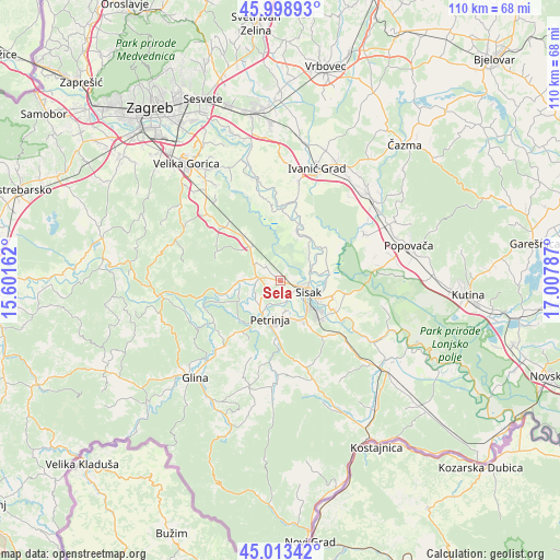
Sela GPS coordinates[2]
45° 30' 29.988" North, 16° 18' 17.064" East
| Map corner | latitude | longitude |
|---|---|---|
| Upper-left | 45.99893°, | 15.60162° |
| Center: | 45.50833°, | 16.30474° |
| Lower-right: | 45.01342°, | 17.00787° |
| Map W x H: | 109.6×109.6 km | = 68.1×68.1mi |
| max Lat: | 46.52694° ⇑46.3% North |
| Sela: | 45.50833° |
| min Lat: | ⇓53.7% South 42.54972° |
| min Long | Sela | max Long |
| 13.52389° | 16.30474° | 19.37694° |
| W 42.5%⇐ | ⇒57.5% E |
Elevation
Elevation of Sela is 101 m = 331 ft, and this is 52.3 m = 172 ft below average elevation for this country.
| Max E: |
827 m = 2713 ft | 66.2% |
| Avg. | 153.3 m = 503 ft | |
| Sela | 101 m = 331 ft | |
Min E: |
-1 m = -3 ft | 33.8% |
See also: Croatia elevation on elevation.city.
Geographical zone
Sela is located in North temperate zone (between Tropic of Cancer and the Arctic Circle). Distance of this North polar circle is 2341.1 km =1454.7 mi to North.| Distance of | km | miles | from Sela |
|---|---|---|---|
| North Pole | 4947 | 3073.9 | to North |
| Arctic Circle | 2341.1 | 1454.7 | to North |
| Tropic Cancer | 2454.1 | 1524.9 | to South |
| Equator | 5060.1 | 3144.2 | to South |


Nearby cities:
15 places around Sela: (largest is in red/bold)
• Budaševo
10.9 km =6.8 mi,  109°
109°
• Gornje Komarevo
14.1 km =8.8 mi,  139°
139°
• Hrastelnica
8.8 km =5.5 mi,  94°
94°
• Lekenik
11.3 km =7 mi,  319°
319°
• Mala Gorica
6.1 km =3.8 mi,  230°
230°
• Martinska Ves
10.1 km =6.3 mi,  33°
33°
• Oborovo
19.8 km =12.3 mi,  349°
349°
• Odra Sisačka
3.6 km =2.2 mi,  104°
104°
• Petrinja
8 km =5 mi,  188°
188°
• Posavski Bregi
19.4 km =12.1 mi,  11°
11°
• Sisak
7.4 km =4.6 mi,  129°
129°
• Strelečko
6.3 km =3.9 mi,  79°
79°
• Stružec
19.6 km =12.2 mi, 83°
• Topolovac
11.5 km =7.1 mi,  117°
117°
• Žabno
3.6 km =2.2 mi, 104°
Sources, notices
• [Note1] Compared only with cities in Croatia existing in our database
• [Src1] Map data: © OpenStreetMap contributors (CC-BY-SA)
• [Src2] Other city data from geonames.org with taken over terms of usage.
• [Src3] Geographical zone / Annual Mean Temperature by Robert A. Rohde @ Wikipedia
