Polača geodata
Polača (Zadarska) is a seat of a second-order administrative division; located in Croatia in Europe/Zagreb (GMT+2) time zone. With population of 1,122 people, there are 408 cities with bigger population in this country. Compared to other cities in Croatia, 84% of cities are located further ↑North; 82.4% of cities are located further →East and 54.4% of cities have higher elevation than Polača. Note1


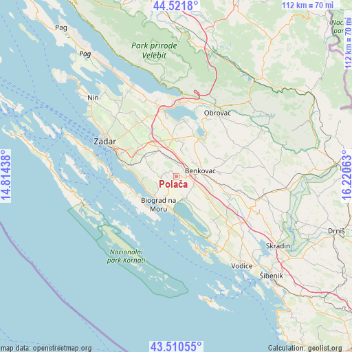
Polača GPS coordinates[2]
44° 1' 5.988" North, 15° 31' 3" East
| Map corner | latitude | longitude |
|---|---|---|
| Upper-left | 44.5218°, | 14.81438° |
| Center: | 44.01833°, | 15.5175° |
| Lower-right: | 43.51055°, | 16.22063° |
| Map W x H: | 112.4×112.4 km | = 69.8×69.8mi |
| max Lat: | 46.52694° ⇑84% North |
| Polača: | 44.01833° |
| min Lat: | ⇓16% South 42.54972° |
| min Long | Polača | max Long |
| 13.52389° | 15.5175° | 19.37694° |
| W 17.6%⇐ | ⇒82.4% E |
Elevation
Elevation of Polača is 118 m = 387 ft, and this is 35.3 m = 116 ft below average elevation for this country.
| Max E: |
827 m = 2713 ft | 54.4% |
| Avg. | 153.3 m = 503 ft | |
| Polača | 118 m = 387 ft | |
Min E: |
-1 m = -3 ft | 45.6% |
See also: Croatia elevation on elevation.city.
Geographical zone
Polača is located in North temperate zone (between Tropic of Cancer and the Arctic Circle). Distance of this Northern Tropic circle is 2288.5 km =1422 mi to South.| Distance of | km | miles | from Polača |
|---|---|---|---|
| North Pole | 5112.7 | 3176.9 | to North |
| Arctic Circle | 2506.8 | 1557.7 | to North |
| Tropic Cancer | 2288.5 | 1422 | to South |
| Equator | 4894.4 | 3041.2 | to South |


Nearby cities:
15 places around Polača: (largest is in red/bold)
• Benkovac
7.8 km =4.8 mi,  76°
76°
• Biograd na Moru
9.9 km =6.2 mi,  212°
212°
• Buković
9.4 km =5.8 mi, 79°
• Debeljak
12.7 km =7.9 mi,  286°
286°
• Drage
14.5 km =9 mi,  172°
172°
• Galovac
11.5 km =7.1 mi,  300°
300°
• Gornji Karin
16.1 km =10 mi,  35°
35°
• Pakoštane
11.8 km =7.3 mi,  183°
183°
• Pašman
12.6 km =7.8 mi,  237°
237°
• Sveti Filip i Jakov
9.2 km =5.7 mi,  229°
229°
• Tinj
3.4 km =2.1 mi,  271°
271°
• Tkon
13.5 km =8.4 mi,  215°
215°
• Turanj
10 km =6.2 mi, 238°
• Zemunik Donji
14.7 km =9.1 mi,  311°
311°
• Škabrnje
9.6 km =6 mi,  327°
327°
Sources, notices
• [Note1] Compared only with cities in Croatia existing in our database
• [Src1] Map data: © OpenStreetMap contributors (CC-BY-SA)
• [Src2] Other city data from geonames.org with taken over terms of usage.
• [Src3] Geographical zone / Annual Mean Temperature by Robert A. Rohde @ Wikipedia
