Pitomača geodata
Pitomača (Virovitičk-Podravska) is a seat of a second-order administrative division; located in Croatia in Europe/Zagreb (GMT+2) time zone. With population of 5,740 people, there are 69 cities with bigger population in this country. Compared to other cities in Croatia, 80% of cities are located further ↓South; 72.4% of cities are located further ←West and 58.9% of cities have higher elevation than Pitomača. Note1


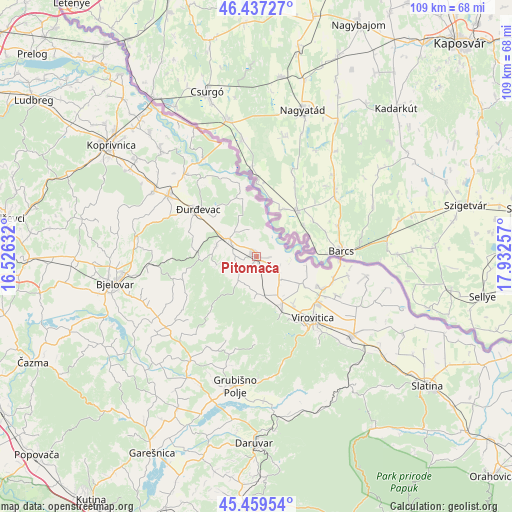
Pitomača GPS coordinates[2]
45° 57' 2.016" North, 17° 13' 45.984" East
| Map corner | latitude | longitude |
|---|---|---|
| Upper-left | 46.43727°, | 16.52632° |
| Center: | 45.95056°, | 17.22944° |
| Lower-right: | 45.45954°, | 17.93257° |
| Map W x H: | 108.7×108.7 km | = 67.5×67.5mi |
| max Lat: | 46.52694° ⇑20% North |
| Pitomača: | 45.95056° |
| min Lat: | ⇓80% South 42.54972° |
| min Long | Pitomača | max Long |
| 13.52389° | 17.22944° | 19.37694° |
| W 72.4%⇐ | ⇒27.6% E |
Elevation
Elevation of Pitomača is 111 m = 364 ft, and this is 42.3 m = 139 ft below average elevation for this country.
| Max E: |
827 m = 2713 ft | 58.9% |
| Avg. | 153.3 m = 503 ft | |
| Pitomača | 111 m = 364 ft | |
Min E: |
-1 m = -3 ft | 41.1% |
See also: Croatia elevation on elevation.city.
Geographical zone
Pitomača is located in North temperate zone (between Tropic of Cancer and the Arctic Circle). Distance of this North polar circle is 2292 km =1424.2 mi to North.| Distance of | km | miles | from Pitomača |
|---|---|---|---|
| North Pole | 4897.8 | 3043.4 | to North |
| Arctic Circle | 2292 | 1424.2 | to North |
| Tropic Cancer | 2503.3 | 1555.5 | to South |
| Equator | 5109.2 | 3174.7 | to South |


Nearby cities:
15 places around Pitomača: (largest is in red/bold)
• Budančevica
7.1 km =4.4 mi,  300°
300°
• Bušetina
11.4 km =7.1 mi,  121°
121°
• Ferdinandovac
11.3 km =7 mi,  348°
348°
• Kalinovac
12.4 km =7.7 mi,  314°
314°
• Kloštar Podravski
6.6 km =4.1 mi, 300°
• Kozarevac
9 km =5.6 mi,  254°
254°
• Otrovanec
3.6 km =2.2 mi,  210°
210°
• Podravske Sesvete
6.2 km =3.9 mi, 347°
• Prugovac
8.7 km =5.4 mi,  284°
284°
• Stari Gradac
5.6 km =3.5 mi, 121°
• Turanovac
14.3 km =8.9 mi, 116°
• Velika Črešnjevica
6.2 km =3.9 mi,  217°
217°
• Vukosavljevica
8.1 km =5 mi,  178°
178°
• Đurđevac
15.9 km =9.9 mi, 309°
• Špišić-Bukovica
11.7 km =7.3 mi,  152°
152°
Sources, notices
• [Note1] Compared only with cities in Croatia existing in our database
• [Src1] Map data: © OpenStreetMap contributors (CC-BY-SA)
• [Src2] Other city data from geonames.org with taken over terms of usage.
• [Src3] Geographical zone / Annual Mean Temperature by Robert A. Rohde @ Wikipedia
