Kozarevac geodata
Kozarevac (Koprivničko-Križevačka) is a populated place; located in Croatia in Europe/Zagreb (GMT+2) time zone. With population of 560 people, there are 798 cities with bigger population in this country. Compared to other cities in Croatia, 79% of cities are located further ↓South; 69.9% of cities are located further ←West and 62.2% of cities have lower elevation than Kozarevac. Note1


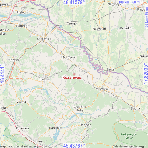
Kozarevac GPS coordinates[2]
45° 55' 44.004" North, 17° 7' 1.992" East
| Map corner | latitude | longitude |
|---|---|---|
| Upper-left | 46.41579°, | 16.4141° |
| Center: | 45.92889°, | 17.11722° |
| Lower-right: | 45.43767°, | 17.82035° |
| Map W x H: | 108.8×108.8 km | = 67.6×67.6mi |
| max Lat: | 46.52694° ⇑21% North |
| Kozarevac: | 45.92889° |
| min Lat: | ⇓79% South 42.54972° |
| min Long | Kozarevac | max Long |
| 13.52389° | 17.11722° | 19.37694° |
| W 69.9%⇐ | ⇒30.1% E |
Elevation
Elevation of Kozarevac is 149 m = 489 ft, and this is 4.3 m = 14 ft below average elevation for this country.
| Max E: |
827 m = 2713 ft | 37.8% |
| Avg. | 153.3 m = 503 ft | |
| Kozarevac | 149 m = 489 ft | |
Min E: |
-1 m = -3 ft | 62.2% |
See also: Croatia elevation on elevation.city.
Geographical zone
Kozarevac is located in North temperate zone (between Tropic of Cancer and the Arctic Circle). Distance of this North polar circle is 2294.4 km =1425.7 mi to North.| Distance of | km | miles | from Kozarevac |
|---|---|---|---|
| North Pole | 4900.2 | 3044.8 | to North |
| Arctic Circle | 2294.4 | 1425.7 | to North |
| Tropic Cancer | 2500.9 | 1554 | to South |
| Equator | 5106.8 | 3173.2 | to South |


Nearby cities:
15 places around Kozarevac: (largest is in red/bold)
• Budančevica
6.6 km =4.1 mi,  22°
22°
• Kalinovac
11.2 km =7 mi,  359°
359°
• Kloštar Podravski
6.5 km =4 mi,  27°
27°
• Lasovac
10.9 km =6.8 mi,  218°
218°
• Otrovanec
6.9 km =4.3 mi,  95°
95°
• Pitomača
9 km =5.6 mi,  74°
74°
• Podravske Sesvete
11.2 km =7 mi,  40°
40°
• Prugovac
4.6 km =2.9 mi,  2°
2°
• Stari Gradac
13.5 km =8.4 mi,  92°
92°
• Velika Pisanica
14.7 km =9.1 mi,  195°
195°
• Velika Črešnjevica
5.5 km =3.4 mi,  116°
116°
• Veliko Trojstvo
14.2 km =8.8 mi,  272°
272°
• Vukosavljevica
10.6 km =6.6 mi, 122°
• Đurđevac
13 km =8.1 mi,  343°
343°
• Šandrovac
7.9 km =4.9 mi,  250°
250°
Sources, notices
• [Note1] Compared only with cities in Croatia existing in our database
• [Src1] Map data: © OpenStreetMap contributors (CC-BY-SA)
• [Src2] Other city data from geonames.org with taken over terms of usage.
• [Src3] Geographical zone / Annual Mean Temperature by Robert A. Rohde @ Wikipedia
